
MP38b
Location: Walpeup
Australian Soil Classification: Sodic, Hypercalcic, Red CHROMOSOL (medium sandy surface)
General Landscape Description: Swale between east-west dune.
Geology: Quaternary (Woorinen Formation) deposits.
Land Use: Cropping.
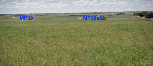 MP38 and MP39 landscape |
Soil Profile Morphology:
Surface Soil
| A1 | 0-20 cm | Strong brown (7.5YR4/6); loamy sand; very weak consistence dry; non calcareous; pH 7.9: |  MP38b profile |
| Subsoil | |||
| B1 | 20-25 cm | Dark brown (7.5YR3/4); sandy clay loam; weak coarse blocky structure; weak consistence moist; non calcareous; pH 8.1: | |
| B21 | 25-35 cm | Yellowish red (5YR5/6) with some yellowish red (5YR4/6); medium clay (sandy); weak coarse blocky structure; weak consistence moist; moderately calcareous; pH 8.6: | |
| B22k | 35-50 cm | Reddish yellow (5YR6/8); light medium clay; weak consistence moist; contains a common (20%) amount of soft and hard carbonate; very strongly calcareous; pH 8.9: | |
| B23k | 50-100 cm | Yellowish red (5YR5/8); light clay becoming clay loam with depth; weak polyhedral structure; firm consistence moist; contains a few (2-5%) hard carbonates (5-10 mm in size) and very many (>50%) soft carbonates; very strongly calcareous; pH 9.6: |
Key Profile Features:
- Texture contrast between sandy surface (A) horizon and subsoil (B21) horizon.
- Large amount of soft carbonate in deeper subsoil.
Soil Profile Characteristics:

| |||||||||||||||||||||||||||||||||||||||||||||||||||||||||||||||||||||||||||||||||||||||||||||||||||||||||||||||||||||||||||||||||||||||
Profile Described By: Mark Imhof and Nathalie Baxter (September 1996).
© State of Victoria (Agriculture Victoria) 1996 - 2025.

This work, Victorian Resources Online, is licensed under a Creative Commons Attribution 4.0 licence. You are free to re-use the work under that licence, on the condition that you credit the State of Victoria (Agriculture Victoria) as author, indicate if changes were made and comply with the other licence terms.
The licence does not apply to ‘branding’ or some ‘images or photographs’ that may be owned by third parties. We ask you to seek prior approval to use images using the VRO feedback form. Access to higher quality images can also be provided on request.
This page was last updated on 23/03/2020.