Soil/Landform Unit 151
Landform Unit Description
Page top
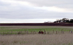 Red cultivated soils on the slopes of this rise near Foxhow |
<0.01% of CMA region This very small singular unit with a sole component occurs west of Foxhow on the north shore of Lake Gnarpurt. It abuts lunettes (Unit 146) and drainage depressions (Unit 166). Remnant native vegetation of this unit is Grassy Woodland. The soils are alkaline (strongly sodic) red texture contrast soils (Sodosols). Given the locality and topographic position, this unit is moderately rapidly drained, but the strongly sodic nature will mean susceptibility to structure decline particularly in the upper soil. Nutrient decline and compaction are also concerns. Land use is grazing; the limited area and the position precludes many primary enterprises. | 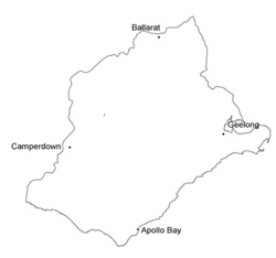 |
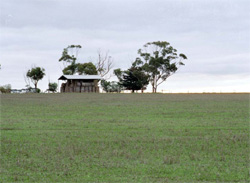 Cropping of this rise has been common given current cropping and stubble retention | 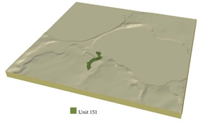 |
 | 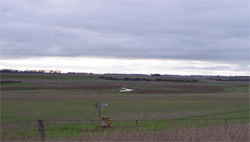 Undulating landscape autting the rise of this unit |
Component | 1 |
Proportion of soil-landform unit | 100% |
| CLIMATE Rainfall (mm) | Annual: 590 |
| Temperature (oC) | Minimum 8, Maximum 19 |
| Precipitation less than potential evapotranspiration | October-March |
| GEOLOGY Age and lithology | |
| Geomorphology | |
| LANDUSE | Uncleared: Nature conservation; water supply Cleared: Beef cattle and sheep grazing; cropping (cereal) |
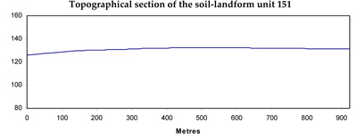
| TOPOGRAPHY Landscape | Gently undulating sandy rise |
| Elevation range (m) | 114-134 |
| Local relief (m) | 20 |
| Drainage pattern | Centripetal |
| Drainage density (km/km2) | 2.5 |
| Landform | Sandy rise |
| Landform element | Rise |
| Slope and range (%) | 2 (0-5) |
| Slope shape | Convex |
| NATIVE VEGETATION Ecological Vegetation Class | Grassy Woodland (20.8%) |
| SOIL Parent material | Sand, silt and clay |
| Description (Corangamite Soil Group) | Alkaline red texture contrast soils (18) |
| Soil type sites | |
| Surface texture | Clay loam |
| Permeability | Moderate to low |
| Depth (m) | <2 |
| LAND CHARACTERISTICS, POTENTIAL AND LIMITATIONS | Texture contrast, moderate water holding capacity and nutrient holding capacity in upper soil, higher in subsoil. Sodic subsoil, often strongly, hardsetting when dry. May be sodic in upper soil also. Moderate site drainage with water shedding common. |


