Soils of the Lowan Region
Grey Clay Plains | Gently Undulating Plains | Gently Undulating Plains (Red Sodosols dominant) | Gently Undulating Rises | Gently Undualting Sand Plains and Rises
Undulating Low Hills | Lunettes | Intermittent Swamps | Lowan Soil Index
The soils and landform of this area were surveyed in 1995 as part of a Land Inventory and Assessment Project for the former Shire of Lowan. |
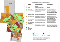
Information on the soil/landscape units mapped can be obtained by clicking on the unit names listed above or by clicking from the map legend. Mapping was carried out at a 1:100 000 map scale which necessitated some generalisation. Users should exercise caution when interpreting map information as it presents a guide only as to the likely soil types in an area. In any one area soils can vary significantly according to landscape, geology and management. Any agricultural enterprise should be based on a proper on-site assessment of the soil and landscape. |

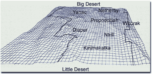
A Digital Elevation Model of the former Lowan Shire area. Note the sequence of NNW/SSE trending ridges across the region.
A number of the soil sites found in this report are shown as dots on the image.
Information from this project has been presented in two reports:
Imhof, M.P, Thompson, S.V and Rees, D.B (1995). Major Agricultural Soils in the Shire of Lowan. Interim report prepared for the Shire of Lowan Land Inventory and Assessment Project. Agriculture Victoria.
Williamson, J.R (editor) (1997). Lowan Land Inventory and Assessment -– Land Systems and Land Management Options. Department of Natural Resources and Environment.


