Salinity Province 99, Pyrenees
|
|
Province Attributes
| Catchment Management Region: | NORTH CENTRAL |
| Priority Status: | High |
| Province Area: | 37,060 ha |
| Recorded Soil Salinity Area 1: | 1,015 ha |
| Dominant Surface Geology Type: | Sedimentary |
| Influence of Geological Structure on Salinity Occurrence/s: | Probable |
| Relevant Geomorphological Mapping Units (GMUs): | 2.1.X |
| Predominant Groundwater Flow Systems (GFSs): | Local & Local/Intermediate |
| Relevant Irrigation Areas: | N/A |
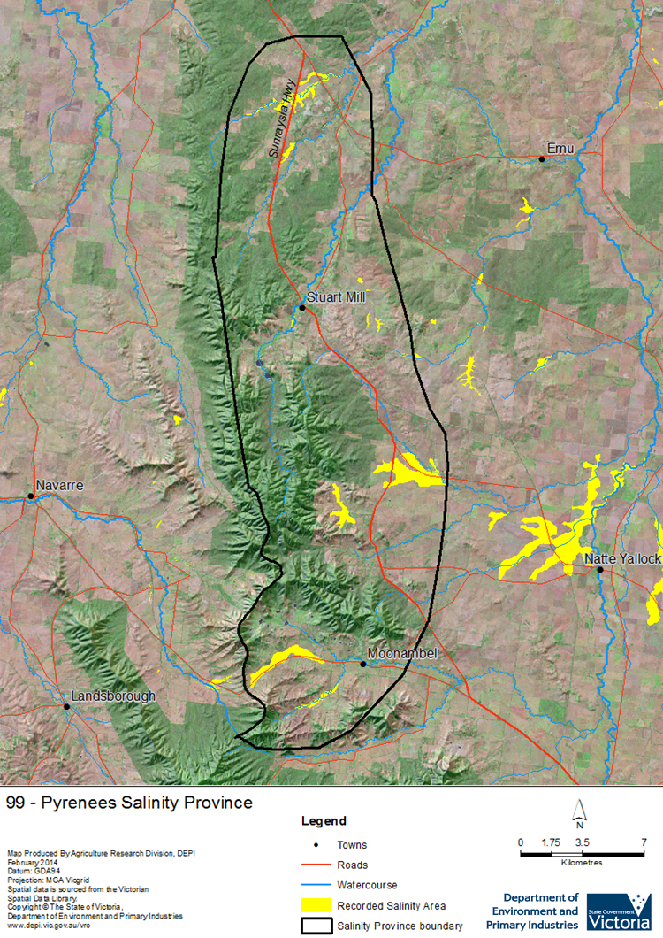
Pyrenees Salinity Province Map

Links to further reading and material related to the North Central Salinity Province
For further information relating to groundwater levels and salinities in this Province please see: Visualising Victoria's Groundwater (VVG)
1 Please Note: The ‘Recorded Soil Salinity Area’ indicated in the Salinity Province Attribute Table, comprises the total geographic area that has been mapped as having, or showing symptoms of, dryland soil salinity at some time (past or present). As dryland salinity occurrence in the Victorian landscape exhibits many different levels of severity and can change due to climate, landuse and vegetation, previously mapped areas may no longer be showing symptoms. In addition, as not all parts of the State have been mapped, or mapped in the same way, the mapping may not have captured some occurrences.
The soil salinity mapping used to calculate this ‘area’ does not cover irrigation regions. In irrigation regions, depth to watertable and watertable salinity mapping has been used to convey the threat of high watertables on soil waterlogging and/or soil salinisation and these areas are not included in this ‘area‘ calculation.
Please contact the Department, your Catchment Management Authority or your rural water provider for more information about salinity in your location.

 The Pyrenees Salinity Province occurs along the eastern slopes of the rocky catchment divide between the North Central and Wimmera catchments. It contains a number of discreet creeks flowing east from this divide, forming deep valleys that incise these slopes then continuing across the flatter alluvial plains in the east of the province. Moonambel, Redbank, Carapooee and Steward Mill are the important locations within the province, each of which has similar groundwater processes. Rocky ridges with "saw tooth" rock exposure in fractured and weathered Palaeozoic rocks provide high recharge zones. Most dryland salinity is associated with local scale Groundwater Flow Systems (GFSs) in alluvial sediments and is expressed along the drainage lines that cross the plains. Further salinity occurs at the ‘break-of-slope’ of the rocky hills and valleys on associated local to intermediate scale GFSs.
