Salinity Province 80, Mornington
|
|
Province Attributes
| Catchment Management Region: | PORT PHILLIP & WESTERNPORT |
| Priority Status: | High |
| Province Area: | 44,750 ha |
| Recorded Soil Salinity Area 1: | 226 ha |
| Dominant Surface Geology Type: | Sedimentary |
| Influence of Geological Structure on Salinity Occurrence/s: | Probable |
| Relevant Geomorphological Mapping Units (GMUs): | 3.3.1, 3.3.X |
| Predominant Groundwater Flow Systems (GFSs): | Local/Intermediate |
| Relevant Irrigation Areas: | N/A |
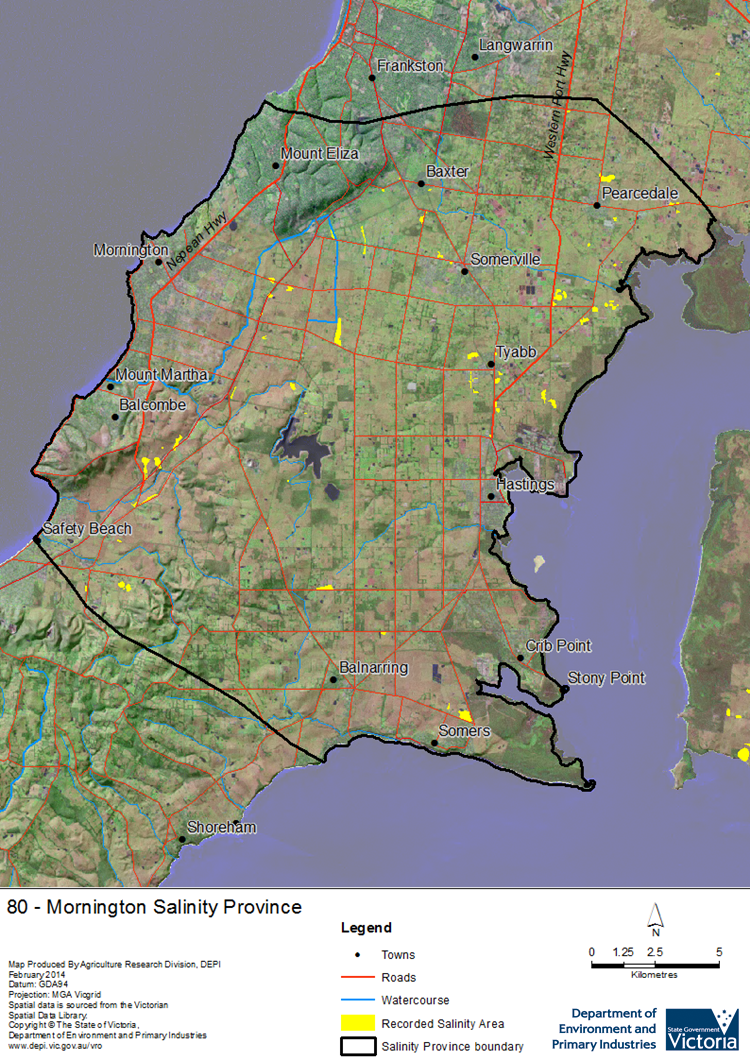
Mornington Salinity Province Map

Links to further reading and material related to the Port Phillip and Westernport Salinity Province
Groundwater Flow Systems (GFS) in the Port Phillip & Westernport CMR
For further information relating to groundwater levels and salinities in this Province please see: Visualising Victoria's Groundwater (VVG)
1 Please Note: The ‘Recorded Soil Salinity Area’ indicated in the Salinity Province Attribute Table, comprises the total geographic area that has been mapped as having, or showing symptoms of, dryland soil salinity at some time (past or present). As dryland salinity occurrence in the Victorian landscape exhibits many different levels of severity and can change due to climate, landuse and vegetation, previously mapped areas may no longer be showing symptoms. In addition, as not all parts of the State have been mapped, or mapped in the same way, the mapping may not have captured some occurrences.
The soil salinity mapping used to calculate this ‘area’ does not cover irrigation regions. In irrigation regions, depth to watertable and watertable salinity mapping has been used to convey the threat of high watertables on soil waterlogging and/or soil salinisation and these areas are not included in this ‘area‘ calculation.
Please contact the Department, your Catchment Management Authority or your rural water provider for more information about salinity in your location.

 The Mornington Salinity Province is a small province on the Mornington Peninsula, about 50 km southeast of Melbourne, about 0.5% of which has been mapped as saline. Landuse is currently about 30% urban and 70% rural, including grazing on improved pasture and high intensity horticulture.
