Chromosols
|
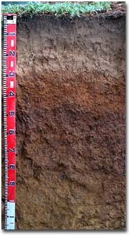
| Chromosols display a significant texture change from loamy upper horizons to clay subsoils which are neither sodic nor strongly acidic. Examples can be found on hillslopes in the uplands and on volcanic plains. Subsoils are strongly mottled and strongly structured with shiny clay peds suggestive of early Pleistocene weathering. Some of the areas mapped may included Sodosols or the very acidic Kurosols because laboratory data are limited. Again, some soils may be Dermosols because of insufficient textural difference between A and B horizons. Structure and permeability are favourable but land use is mainly grazing. |
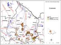
| This map of Chromosols in the North Central region has been developed by Jim Rowan and is based on the Land Systems of Victoria (1:250 000). It shows areas where Chromosols are most likley to occur within the region. Note that other soil types may also occur within these mapped areas (although they are likely to be a more minor component). |  Chromosols North Central Region |
Volcanic plain Chromosols are found on basalts near the main divide. The surface horizons contain abundant quartz, indicating the presence of transported particles. Vertosols usually occur on adjacent valley alluvium.


