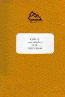
A Study of Land Capability in the Shire of Ballan
This report "A Study of Land Capability in the Shire of Ballan" describes a study carried out by P. J. Jeffery and R. T. Costello - Land Capability of the former Soil Conservation Authority covering the environment of the Shire of Ballan and the capability of the different types of land to support various land uses – particularly subdivision.
There are twenty-six map units described in the study. Many of these units are complex land systems containing up to three or four different but related types of land (i.e. land components). In some cases, individual land components have been mapped as units. The mapping is at a fairly broad scale (1:100 000) suitable as input for broad-scale planning but not adequate for individual site decisions.
The capability of the land to support three main activities has been examined.
1. Erosion risk associated with soil disturbance
2. Constraints on construction (small building, secondary road, etc)
3. Effluent disposal by soil absorption – risk of failure and difficulties of installation.
The rating value is interpreted in terms of the level of special management required to overcome the limitations imposed by the land features, e.g. slopes, stoniness, etc. The ratings for specific activities or aspects of land performance are combined to give an overall rating for rural subdivision – farmlets with houses, low-cast access, effluent disposal by soil absorption. The rating again is interpreted as the levels of special management required to minimise hazard to the land, the water supply and the user.
| Soils on Quaternary Unconsolidated Sediments |
| Soils on Tertiary Unconsolidated and Consolidated Sediments |
| Soils on Basaltic Terrain |
| Soils on Granitic Terrain |
| Soils on Older Consolidated Sediments |
 | A Study of the Land Capability in the Shire of Ballan (PDF 1432 KB) A Study of the Land Capability in the Shire of Ballan (DOC - 12191 KB) To view the information PDF requires the use of a PDF reader. This can be installed for free from the Adobe website (external link). | Maps Map 2 - Erosion hazard associated with disturbed Soil Map 3 - General Construction Map 4 - Effluent Disposal by Soil Absorption Map 5 - Land Capability Assessment - Rural Subdivision |


