Your gateway to a wide range of natural resources information and associated maps

Victorian Resources Online

Maps showing Declared Special Water Supply Catchments Areas in Corangamite

Back to: Declared Special Water Supply Catchment Areas in the Corangamite CMA
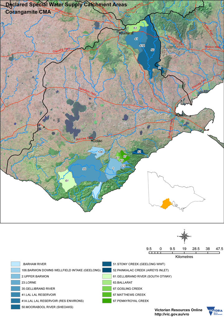
Map showing Declared Special Water Supply Catchment Areas in the Corangamite Region

No
Catchment Name
2Upper Barwon
23Lorne
35Gellibrand River
Lal Lal Reservoir
50Moorabool River (Sheoaks)
52Painkalac Creek (Aireys Inlet)
61Gellibrand River (South Otway)
63Ballarat
67Pennyroyal, Matthews & Gosling Creeks
Barham River
106Barwon Downes (Wellfield Intake)

Declared Special Water Supply Catchment Areas in Corangamite CMA (PDF - 4MB). A PDF file is provided that can be viewed within most modern browsers or using the free Adobe PDF reader. It is provided at a resolution suitable for printing.
Page top