
5.6 Hills and low hills (Mount Arapiles)
|
A number of topographically significant and materially different features appear within the North West Dunefields and Plains as inliers. The major inliers include the largest inlier, Mount. Arapiles and associated outlier (Mitre Rock,) as well as Mount. Jeffcott and lower weathered Palaeozoic sediments often subsumed by surfical deposits. This is a similar category to that within the Northern Riverine Plains (unit 4.4). | 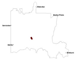 |
Soil-landform unit | Unit description | Area (km2) |
| Arapiles steep hills | Steep hills | 46 |
© State of Victoria (Agriculture Victoria) 1996 - .

This work, Victorian Resources Online, is licensed under a Creative Commons Attribution 4.0 licence. You are free to re-use the work under that licence, on the condition that you credit the State of Victoria (Agriculture Victoria) as author, indicate if changes were made and comply with the other licence terms.
The licence does not apply to ‘branding’ or some ‘images or photographs’ that may be owned by third parties. We ask you to seek prior approval to use images using the VRO feedback form. Access to higher quality images can also be provided on request.
This page was last updated on .