
2.1.6 Eruption points, volcanic plains and plateaus (Barton)
|
Undulating basalt plains within the WCMA region are confined to the upper reaches of the Mount William Creek catchment. The plains near Barton lead to vast, broad lava flows of the Western Plains. The plains have historically been cleared as part of significant pastoral runs of Western Victoria (e.g. Barton Station). | 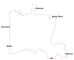 |
The basalt plains are known for their heavy clay soils that often result in surface ponding with many of these soils likely to have been Hydrosols prior to surface drainage. Cracking clays soils (Vertosols) with dark brown clay loam to heavy clay topsoils (slightly acidic) overlie massive bleached subsurface horizons with ferruginised nodules. A clear boundary exists to the brown to yellow brown heavy clay subsoil that is neutral to alkaline. In addition to cracking clays, sodic brown, yellow and grey texture contrast soils (Sodosols) are dominant with dark greyish brown clay loams overlying a conspicuously bleached horizon before an abrupt change to mottled heavy clay subsoils. Throughout ferromanganiferous concretions occur. Soils may have experienced varying amounts of aeolian sand into topsoils from arid palaeoenvironments.
Red Gum Wetlands of red gums (Eucalyptus camaldulensis) and swamp gums (primarily confined to swamps and poorly drained plains) are the only indigenous tree species on the basalt plains with sandy woodlands dominant on the fringes of these landscapes. Plains Grassland and Sedge Wetlands of wallaby, brome and kangaroo grasses are thought to be a natural sub-formation (Sibley 1967).
Swamps and alluvial plains are scattered across the basalt plains where a defined lateral stream has not yet developed (Cayley & Taylor 2001). These swampy wetlands are habitat refuges to many flora and faunal communities including brolgas.
Soil-landform unit | Unit description | Area (km2) |
| Barton lava plains | Lava plain | 21 |
© State of Victoria (Agriculture Victoria) 1996 - .

This work, Victorian Resources Online, is licensed under a Creative Commons Attribution 4.0 licence. You are free to re-use the work under that licence, on the condition that you credit the State of Victoria (Agriculture Victoria) as author, indicate if changes were made and comply with the other licence terms.
The licence does not apply to ‘branding’ or some ‘images or photographs’ that may be owned by third parties. We ask you to seek prior approval to use images using the VRO feedback form. Access to higher quality images can also be provided on request.
This page was last updated on .