
Gently Undulating Plains
Description of the Land System
Landform and Distribution
This unit consists of a complex of plains and low gently undulating terrain between NNW/SSE trending rises and low hills. It differs from the Grey Clay Plains unit in that it contains a greater proportion of more undulating land (forming low rises) and tends to be broader in extent, as well as containing a greater range of soil types. Slopes generally range from 0-2%. These plains usually occur in the middle and northern parts of the Lowan district. Gilgai microrelief is common in areas where Grey Vertosols exist.
The parent material is a combination of lowland deposits generally laid down in lagoonal, swamp or lacustrine environments. Windblown sandy material also occurs (particularly in the Propodollah area) and many of these have been mapped separately as the Undulating Sand Plains and Rises unit.
Adjacent Land Systems
This Land System is generally adjacent to the Gently Undulating Sand Plains and Rises unit and the Undulating Low Hills (Stranded Beach Ridges) unit. The Gently Undulating Rises Land System is commonly located within the Gently Undulating Plains Land System. The Gently Undulating Plains unit is generally lower in the landscape than the adjacent Land System. In the south and east of the study area, the Grey Clay Plains unit also adjoins this Land System.
Native Vegetation
- Black Box (E. largiflorens) and Lignum Bush (Muehlenbeckia cunninghamii) occur on lower lying areas which may flood occasionally.
- Grey Box (E. microcarpa) occurs in slightly better drained positions.
- Buloke (Casuarina leuhmanii).
- Mallee eucalypts also occur in more norther, in lower rainfall areas.
Soil Types
Two general soils occur within this land system: Grey, Red and Brown Vertosols (i.e. uniform grey, red and brown cracking clay soils) and Brown Sodosols (duplex sandy loam and sandy clay loam overlying clays). Some Calcarosols also occur. Grey Vertosols e.g. Site LS7 and Site LS13A) and Hypercalcic Grey Vertosols e.g. Site LS16 generally occur on relatively flat areas and in depressions. Vertic Calcarosols (Site LS13B) can also occur in association with Grey Vertosols. These Calcarosols differ from the latter in that they have a fine sandy clay loam or clay loam surface horizon which grades into a light clay at the top of the subsoil. The deeper subsoil is a coarsely structured medium to heavy clay with similar properties to Vertosols.
Red Vertosols (Site LS11) and Brown Vertosols (Site LS13) generally occur in slightly higher and better drained positions than the Grey Vertosols. These soils tend to have moderately alkaline light medium clay surface horizons which are underlain by red or brown strongly structured heavy clay. These are usually strongly alkaline and may or may not be sodic. Below this horizon the clay becomes paler and more sodic with depth. These soils may form intergrades with Red and Brown Sodosols on adjacent low rises.
Soils on the low rises are usually Yellow, Brown (Site LS11A) or Red Sodosols depending to some extent on drainage conditions. In general, they have a thin (often about 15 cm) alkaline sandy clay loam (and less frequently sandy loam) surface horizon which is hardsetting when dry. A sporadic bleach may occur in the subsurface horizon. The subsoil is usually a medium to heavy clay which is strongly alkaline and sodic. Zones of soft and hard carbonate accumulations also occur within the subsoil. In some cases the subsoil can contain large amounts of calcium carbonate (e.g. Site LS24).
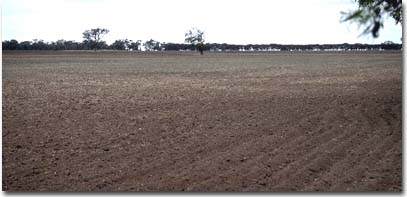
A low rise on a Gently Undulating Plain east of Netherby. Soils on the low rises are generally Red or Brown Sodosols.
Soil Characteristics and Management Options
© State of Victoria (Agriculture Victoria) 1996 - .

This work, Victorian Resources Online, is licensed under a Creative Commons Attribution 4.0 licence. You are free to re-use the work under that licence, on the condition that you credit the State of Victoria (Agriculture Victoria) as author, indicate if changes were made and comply with the other licence terms.
The licence does not apply to ‘branding’ or some ‘images or photographs’ that may be owned by third parties. We ask you to seek prior approval to use images using the VRO feedback form. Access to higher quality images can also be provided on request.
This page was last updated on .