
Ripplebrook (Rb)
|
Geology | 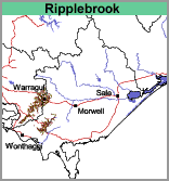 |
Land use
Generally grazing of beef or dairy cattle. These valleys were originally forested with swamp and manna gum with some swamp paperbark, black wattle and hazel. They have been largely cleared for improved pasture.
Soils
The soils of the Ripplebrook mapping unit are similar to those classified as Riverine (riv) but differ mainly in that the sediments are largely derived from basaltic soils. The surface soils are generally clay loams to silty clay loams, occasionally light clays. By about 60 cm there is a weak increase in soil texture to light clay, and medium clays are generally encountered before 1 m depth. The soil colours are predominantly brown throughout because the soils have originated from basalt. Soil Pit GP14 is an example of a Hydrosol which occurs near the Ellinbank Research Institute. By contrast, the valley soils classified as Riverine (riv) are not largely derived from basaltic soils. These soils are generally higher in fine sand throughout and have fine sandy loam to fine sandy clay loam surface soils.
© State of Victoria (Agriculture Victoria) 1996 - .

This work, Victorian Resources Online, is licensed under a Creative Commons Attribution 4.0 licence. You are free to re-use the work under that licence, on the condition that you credit the State of Victoria (Agriculture Victoria) as author, indicate if changes were made and comply with the other licence terms.
The licence does not apply to ‘branding’ or some ‘images or photographs’ that may be owned by third parties. We ask you to seek prior approval to use images using the VRO feedback form. Access to higher quality images can also be provided on request.
This page was last updated on .