
Groundwater Flow Systems Report
Back to Salinity Management
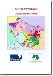
Port Phillip & Westernport Groundwater Flow Systems (2004)
Eighteen Groundwater Flow Systems have been delineated in the Port Phillip and Westernport region - based on the model put forward by the National Land and Water Resources Audit. Consensus on the flow systems was an outcome of a three-day workshop held in October 2003, and subsequent discussions with regional experts.
This report was prepared by Peter Dahlhaus (Dahlhaus Environmental Geology Pty Ltd), David Heislers (Department of Primary Industries, Bendigo), Darrell Brewin (Darrell Brewin and Associates), John Leonard (John Leonard Consulting Services Pty Ltd), Phil Dyson (Phil Dyson and Associates Pty Ltd) and Don Cherry (Department of Primary Industries, Bendigo) for the Port Phillip and Westernport Catchment Management Authority.
To view the information PDF requires the use of a PDF reader. This can be installed for free from the Adobe website (external link).
 | 1 | Introduction (PDF 472KB) 1.1 Scope, authorship & sources of information |
2 | Groundwater Flow Systems (PDF 264KB) 2.1 PPWP CMA GFS | |
3 | GFS descriptions (PDF 66KB) 3.1 Landscape attributes 3.2 Hydrogeology 3.3 Salinity 3.4 Risk 3.5 Conceptual model(s) | |
4 | Salinity Management Options (PDF 222KB) 4.1 Salinity management & groundwater flow systems 4.2 Salinity management opportunities in dryland agriculture 4.3 Salinity management opportunities for irrigated agriculture & horticulture 4.4 Salinity management opportunities for urbanised environments 4.5 Planning frameworks | |
5 | Considerations in using GFS for salinity management (PDF 95KB) | |
| Note: GFS1-18 reports listed in table below | ||
| References & Bibliography (PDF 64KB) | ||
| Appendix 1 (PDF 44KB) |
To view the information PDF requires the use of a PDF reader. This can be installed for free from the Adobe website (external link).
Port Phillip and Westernport Groundwater Flow Systems
Number | Dominant Flow System | Sub-dominant Flow System | Description | PDF size |
| GFS1 | Local | Quaternary sediments | 47KB | |
| GFS2 | Local | Gravel and sand sediments | 127KB | |
| GFS3 | Local | Nepean barrier dunes | 70KB | |
| GFS4 | Local | Greenstone ranges | 196KB | |
| GFS5 | Local | Intermediate | Swamps and back-dune wetlands | 271KB |
| GFS6 | Local | Intermediate | Weathered Older Volcanics | 118KB |
| GFS7 | Local | Intermediate | Fractured Older Volcanics | 65KB |
| GFS8 | Local | Intermediate | Acid volcanics | 64KB |
| GFS9 | Local | Intermediate | Granitic rocks | 143KB |
| GFS10 | Local | Intermediate | Brighton Group sediments | 185KB |
| GFS11 | Local | Intermediate | Werribee Delta | 256KB |
| GFS12 | Local | Intermediate | Rowsley Valley complex | 109KB |
| GFS13 | Local | Intermediate | Mornington fractured bedrock | 153KB |
| GFS14 | Local | Intermediate | Strzelecki Grop rocks | 176KB |
| GFS15 | Local | Intermediate | Fractured Palaeozoic rocks | 79KB |
| GFS16 | Intermediate | Local | Weathered Palaeozoic rocks | 149KB |
| GFS17 | Intermediate | Regional | Westernport plain | 102KB |
| GFS18 | Regional | Intermediate | Volcanic Plains | 863KB |

© State of Victoria (Agriculture Victoria) 1996 - .

This work, Victorian Resources Online, is licensed under a Creative Commons Attribution 4.0 licence. You are free to re-use the work under that licence, on the condition that you credit the State of Victoria (Agriculture Victoria) as author, indicate if changes were made and comply with the other licence terms.
The licence does not apply to ‘branding’ or some ‘images or photographs’ that may be owned by third parties. We ask you to seek prior approval to use images using the VRO feedback form. Access to higher quality images can also be provided on request.
This page was last updated on .