
Type H
This is the second highest member of the catena (slope sequence of hill soils). Its profile is marked by large amounts of quartz gravel and stone, scattered both on the surface and in the A horizon. It has a red clay B horizon, as in Type B. The dense clay found in the deep subsoil of Type B and other soil types is absent here, and the profile usually merges into weathered rock before 1 metre depth.
The type appears to be associated with the quartz reefs traversing the Ordovician sediments.
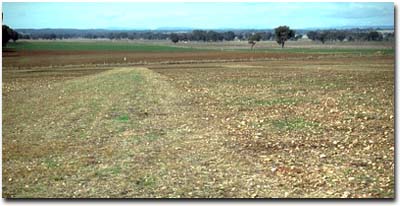 Typical landscape associated with the Type H mapping unit. |
Typical Profile
| Surface | ||
| A1 | 0-7 cm | Dark dull brown (7.5YR4/4) loam; light to moderate quartz gravel, with heavy to moderate gravel on the surface; well structured and loose in its natural state; grading into: |
| A2 | 7-23 cm | Dull reddish brown or brown clay-loam; with heavy quartz gravel and stone; 7 to 20 cm thick; sharply separated from: |
| Subsoil | ||
| B21 | 23-56 cm | Dark red to bright red-brown (10YR4/8 - 2.5YR6/8) clay; quartz grit and occasional floaters; friable when moist; grading into: |
| B22 | 56-114 cm | Dark brownish red and greyish yellow mottled clay, grading into yellow mottled material in the deeper profiles; the horizon varies considerably in thickness, but usually by 91 cm it contains weathered sandstone and quartz, which increases with depth. |
Soil Pit Site NE40 is an example of Type H soil.
Variations
A low hill in the northern extremity of the area is marked by large amounts of quart gravel and stone throughout the profile, instead of only in the surface horizon. The red clay of the B horizon is discontinuous and it occurs only in pockets between the rock. At about 30 cm quartz or quartzite replaces it. An inscription shows the occurrence of this variant on the soil map.
The type also includes a small area of soil with a thicker clay loam surface. The soil here was originally under vines and it may owe its heavier surface texture to deep ploughing.
© State of Victoria (Agriculture Victoria) 1996 - .

This work, Victorian Resources Online, is licensed under a Creative Commons Attribution 4.0 licence. You are free to re-use the work under that licence, on the condition that you credit the State of Victoria (Agriculture Victoria) as author, indicate if changes were made and comply with the other licence terms.
The licence does not apply to ‘branding’ or some ‘images or photographs’ that may be owned by third parties. We ask you to seek prior approval to use images using the VRO feedback form. Access to higher quality images can also be provided on request.
This page was last updated on .