
Land and Water Management
- Declared Water Supply Catchments
- Land Degradation
- Bugs (Cryptozoa) of the Springhurst Byawatha Hills
- Salinity Management in the North East Catchment Management Region
- Catchment Condition Monitoring
- Floodplain Management
- Landholder Groups
- Invasive Plants
- North East Sustainability and Science Information (NESSI) Newsletter
- Irrigated Agriculture
- Declared Water Supply Catchments - North East
|
Current land and water management issues in the North East region include catchment management, catchment planning (including Declared Water Supply Catchment management), river health and management issues, water quality, floodplain management, salinity management, catchment condition monitoring, and land degradation. | 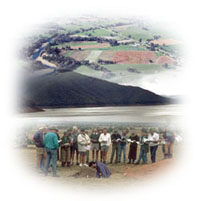 |
Floodplain Management
Information on Floodplain Management on the DEPI website.
Related Links
DSE's Catchment Information mapper website (external link) provides interactive access to data and information on vegetation, salinity, floodways, 1 in 100 year floods, groundwater bores and salinity observation bores.
A full text downloadable version of the former Land Conservation Council's Final Recommendations for the North-Eastern Area (Benalla - Upper Murray) Review (January 1986) is available on the Victorian Environmental Assessment Council website. These provide an ongoing framework for public use of land in the area. Recommendations in the text incorporate those of the LCC's original North-eastern Area Districts 1, 2 and 4 investigations, and have been edited to reflect government variations and amendments at the time of approval, and subsequent changes. The recommendations are grouped under major headings, such as Parks, Flora and Fauna Reserves, Agriculture, State forest and so on. Key recommendations are for Mount Lawson State Park, Wodonga and Mount Mitta Mitta Regional Parks.
A full text downloadable version of the former Land Conservation Council's Final Recommendations for the North-Eastern Area (Districts 3, 4, 5) (April 1977) (external link) is available on the Victorian Environmental Assessment Council website. These provide an ongoing framework for public use of land in the area. The recommendations in the text have been edited to reflect government variations and amendments at the time of approval, and subsequent changes. The recommendations are grouped under major headings, such as Parks, Reference Areas, Wildlife, Hardwood Production, Bushland Reserves and so on. Key recommendations are for Mount Buffalo National Park, Wabonga Plateau State Park, Mount Pilot Multi-purpose Park and Chiltern Regional Park.
A full text downloadable version of the former Land Conservation Council's Final Recommendations for the Alpine Area Special Investigation (November 1983) is available on the Victorian Environmental Assessment Council website. These provide an ongoing framework for public use of land in the area. The recommendations in the text incorporate those of the LCC's original Alpine investigation, and have been edited to reflect government variations and amendments at the time of approval, and subsequent changes. The recommendations are grouped under major headings, such as The Alpine Park System, Wilderness, Reference Areas, Flora and Fauna Reserves, Agriculture, State forest and so on. Key recommendations are for substantial additions to the Alpine Park system.
The Victorian Landcare and Catchment Management Magazine online site (external link) of DSE provides copies of all these magazines dating back to 1996.
Reference
North East Catchment and Land Protection Board (NECALPB) (1997). Regional Catchment Strategy. Victoria.
© State of Victoria (Agriculture Victoria) 1996 - .

This work, Victorian Resources Online, is licensed under a Creative Commons Attribution 4.0 licence. You are free to re-use the work under that licence, on the condition that you credit the State of Victoria (Agriculture Victoria) as author, indicate if changes were made and comply with the other licence terms.
The licence does not apply to ‘branding’ or some ‘images or photographs’ that may be owned by third parties. We ask you to seek prior approval to use images using the VRO feedback form. Access to higher quality images can also be provided on request.
This page was last updated on .