
Riversdale West Railway Cutting
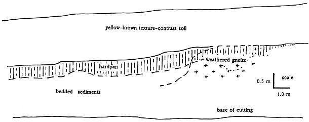
Figure 4: Stratigraphy of the southern side of the Riversdale West cutting.
Riversdale West cutting (Site No. 3) lies to the east of Tallangatta (see Figure 4 and Figure 2d). The railway cutting exposes more hardpan of the Tallangatta type, in alluvial-colluvial sediments that originate from the steep valley side slopes to the south. The hardpan is also evident in the well weathered gneiss where it cuts through the lowest part of the saddle.
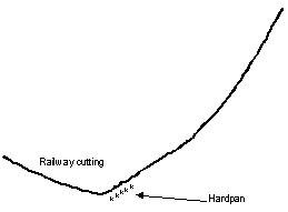 Figure 2d: Cross section of the piedmont, in the valley of the Mitta River at Riversdale West. | ||
The soil at this site has a well-developed hardpan at about 1.5 m (Photo 6). The hardpan is more-or-less parallel to the present soil surface, but dips at a slightly steeper angle down-slope to the east (Photo 7).
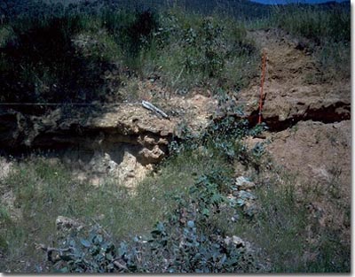 Photo 6: Riversdale West cutting with hardpan. | |
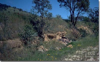 Photo 7: Riversdale West cutting showing steeper dip of hardpan than the soil surface. |
The hard pan is continuous with an indurated zone at the top of the gneissic saprolite in the saddle to the west (Figure 4 and Plate 8). The hardpan and soils in the Tallangatta and Riversdale West cuttings are similar.
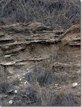 Photo 8: Indurated gneissic saprolite at the hardpan level in the Riversdale West cutting. | |
© State of Victoria (Agriculture Victoria) 1996 - .

This work, Victorian Resources Online, is licensed under a Creative Commons Attribution 4.0 licence. You are free to re-use the work under that licence, on the condition that you credit the State of Victoria (Agriculture Victoria) as author, indicate if changes were made and comply with the other licence terms.
The licence does not apply to ‘branding’ or some ‘images or photographs’ that may be owned by third parties. We ask you to seek prior approval to use images using the VRO feedback form. Access to higher quality images can also be provided on request.
This page was last updated on .