
Coastal dunes (Symbol: cd)
Geology
Recent aeolian sediments
Landform
Longitudinal dunefield parallel to the coastline.
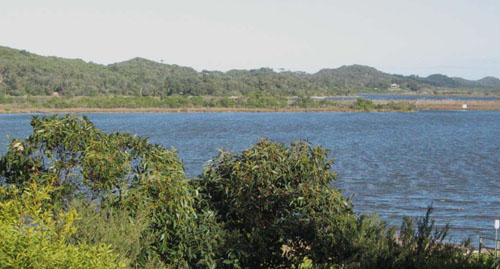
Coastal dunes near the Snowy River mouth, Marlo
Previous maps and reports
This map unit was mapped as Booran 1 Land System by Aldrick et al. (1992). In the previous reports on ‘Major Agricultural Soils of West Gippsland’ by Sargeant and Imhof (2000), all of the dunes fronting the coast are grouped under coastal dunes.
Native vegetation
Coastal dune scrub/coastal dune grassland mosaic.
Soils
All of the soils are sands and variations in surface colour are mainly due to differences in organic matter content. The subsoil sands generally range in colour from pale brownish grey to brownish yellow and occasionally light reddish brown. Although the surface soils are generally non-calcareous and neutral to slightly acidic, the subsoils are always moderately to strongly alkaline and frequently highly calcareous.
This map unit is intrinsically unstable, with youthful, often mobile, unconsolidated materials and droughty soils susceptible to wind erosion and loss of nutrients through leaching.
© State of Victoria (Agriculture Victoria) 1996 - .

This work, Victorian Resources Online, is licensed under a Creative Commons Attribution 4.0 licence. You are free to re-use the work under that licence, on the condition that you credit the State of Victoria (Agriculture Victoria) as author, indicate if changes were made and comply with the other licence terms.
The licence does not apply to ‘branding’ or some ‘images or photographs’ that may be owned by third parties. We ask you to seek prior approval to use images using the VRO feedback form. Access to higher quality images can also be provided on request.
This page was last updated on .