
Soil/Landform Unit 192
Landform Unit Description
Page top
 Deep alluvial soils have been derived from alluvial and colluvial sediments from the Barrabool Hills and hills of Waurn Ponds |
<0.01% of CMA region The undulating alluvial plains and drainage depression in the Waurn Ponds areas comprises predominantly Paleogene marine clay with Recent alluvial material and vegetation classes Swampy Riparian Woodland and Grassy Woodland. These deep soils of the Western Plains are mainly alkaline black texture contrast soils. Surface soil horizons are moderate in plant available nutrients, and the deep soils have high water holding capacities. Most areas have been cleared for cropping and grazing, while the uncleared areas support open woodlands. The main land hazards to land use are waterlogging, gully erosion and sodic subsoils. | 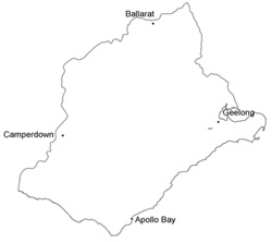 |
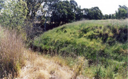
 Hillslopes at Waurn Ponds lead directly to this alluvial valley with deep soils | 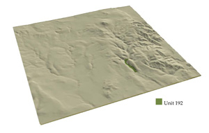 |
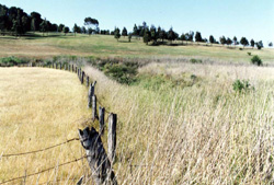
 | 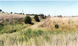 Weeds have infested much of the cleared land along the alluvial valley |
Component | 1 | 2 |
Proportion of soil-landform unit | 75% | 25% |
| CLIMATE Rainfall (mm) | Annual: 630 | |
| Temperature (oC) | Minimum 10, Maximum 19 | |
| Precipitation less than potential evapotranspiration | October–April | |
| GEOLOGY Age and lithology | Paleogene marine clay, Recent clay, sand and gravel | |
| Geomorphology | ||
| LANDUSE | Uncleared: Nature conservation; water supply Cleared: Cropping; sheep and beef cattle grazing | |
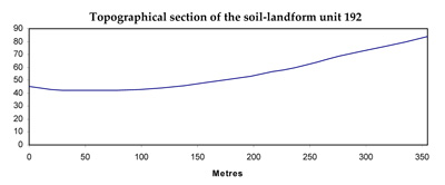
| TOPOGRAPHY Landscape | Alluvial plain | |
| Elevation range (m) | 31–83 | |
| Local relief (m) | 40 | |
| Drainage pattern | Dendritic | |
| Drainage density (km/km2) | 4.1 | |
| Landform | Plains | Drainage lines |
| Landform element | ||
| Slope and range (%) | 1 (0–3) | 2 (1–5) |
| Slope shape | Straight | Concave |
| NATIVE VEGETATION Ecological Vegetation Class | Swampy Riparian Woodland (2.9%) , Grassy Woodland (2.1%) | |
| SOIL Parent material | Clay silt and sand | Clay silt and sand |
| Description (Corangamite Soil Group) | Alkaline black texture contrast soils (32) | Alkaline black texture contrast soils (32) |
| Soil type sites | SW88, SW95, OTR492 | |
| Surface texture | Clay loam | Clay loam |
| Permeability | Moderate to low | Low |
| Depth (m) | >2 | >2 |
| LAND CHARACTERISTICS, POTENTIAL AND LIMITATIONS | Texture contrast, moderate to high water holding capacity and nutrient holding capacity in surface soil. Often sodic clay subsoil, hardsetting when dry. Poor to moderate site drainage. High organic matter may alleviate compaction and water logging susceptibility in surface soil. | Texture contrast, moderate to high water holding capacity and nutrient holding capacity in surface soil. Often sodic clay subsoil, hardsetting when dry. Poor to moderate site drainage, subject to inundation. High organic matter may alleviate compaction and water logging susceptibility in surface soil. |
© State of Victoria (Agriculture Victoria) 1996 - .

This work, Victorian Resources Online, is licensed under a Creative Commons Attribution 4.0 licence. You are free to re-use the work under that licence, on the condition that you credit the State of Victoria (Agriculture Victoria) as author, indicate if changes were made and comply with the other licence terms.
The licence does not apply to ‘branding’ or some ‘images or photographs’ that may be owned by third parties. We ask you to seek prior approval to use images using the VRO feedback form. Access to higher quality images can also be provided on request.
This page was last updated on .