
Soil/Landform Unit 149
Landform Unit Description
Page top
 Hay production combined with cropping and dairy farming are the main land uses of the plains and associated lunettes south of the Princes Highway near Swan Marsh |
0.01% of CMA region This unit consists of gently undulating lunettes as part of an alluvial/aeolian complex within the Western Plains of the Corangamite region. The lunettes are denoted by their gentle slopes and crest as part of the sedimentary plains around Swan Marsh, south of Lake Corangamite. These single lunettes have minor remnant vegetation including Grassy Woodland and Aquatic Herbland/Plains Sedgy Wetland Mosaic. Vegetation indicates that the soils of lower slopes are intermixed with plains of former and current swamps that support aquatic habitats. Soils are black gradational and likely to have calcium nodules/concretions and significant sodium with depth. Land use is mainly dairy farming with hay production common on these soils that produce lush perennial and annual pastures. Soil compaction (including pugging by cattle) along with waterlogging are minor erosion hazards of these gentle lunettes. | 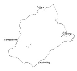 |
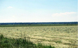
 In the distance a gentle lunette occurs on teh low level plains around Swan Marsh. Here peat is extracted from the swamp and dumped on the slight rise of the lunette | 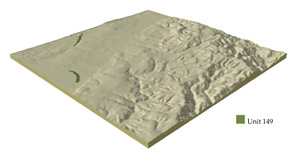 |
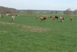
 | 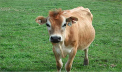 Dairy farming is the major land use on this lunette with peat extraction |
Component | 1 |
Proportion of soil-landform unit | 100% |
| CLIMATE Rainfall (mm) | Annual: 820 |
| Temperature (oC) | Minimum 8, Maximum 19 |
| Precipitation less than potential evapotranspiration | November-March |
| GEOLOGY Age and lithology | Source bordering dune, Recent clay, sand and gravel and minor scoria |
| Geomorphology | |
| LANDUSE | Uncleared areas: Water supply; nature conservation Cleared areas: Dairy farming; beef cattle grazing; cropping; peat extraction |
| TOPOGRAPHY Landscape | Gently undulating lunettes |
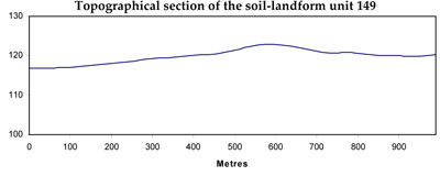
| Elevation range (m) | 119-140 |
| Local relief (m) | 8 |
| Drainage pattern | Dendritic |
| Drainage density (km/km2) | 2.1 |
| Landform | Lunettes |
| Landform element | Lunette |
| Slope and range (%) | 4 (1-9) |
| Slope shape | Convex |
| NATIVE VEGETATION Ecological Vegetation Class | Grassy Woodland (0.6%), Aquatic Herbland / Plains Sedgy Wetland Mosaic (0.5%) |
| SOIL Parent material | Aeolian clay, silt and sand |
| Description (Corangamite Soil Group) | Neutral and alkaline black gradational soils (9) |
| Soil type sites | |
| Surface texture | Clay loam, occasionally light clay |
| Permeability | Moderate to high |
| Depth (m) | >2 |
| LAND CHARACTERISTICS, POTENTIAL AND LIMITATIONS | Friable structured soil. Soil depth is deep to very deep with high water holding capacity. Generally well drained to moderately well drained and high nutrient holding capacity. May grade between a heavy gradational soil and a self-mulching clay soil. |
© State of Victoria (Agriculture Victoria) 1996 - .

This work, Victorian Resources Online, is licensed under a Creative Commons Attribution 4.0 licence. You are free to re-use the work under that licence, on the condition that you credit the State of Victoria (Agriculture Victoria) as author, indicate if changes were made and comply with the other licence terms.
The licence does not apply to ‘branding’ or some ‘images or photographs’ that may be owned by third parties. We ask you to seek prior approval to use images using the VRO feedback form. Access to higher quality images can also be provided on request.
This page was last updated on .