
Soil/Landform Unit 119
Landform Unit Description
Page top
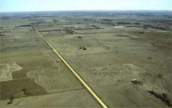 Aerial view of the gently undulating basalt plains near Bannockburn |
2.40% of CMA region This large unit has a few major occurrences in the Lethbridge, Bannockburn and Mount Pollock areas. As part of the volcanic Western Plains, this unit comprises landform components including stony undulating rises, and depressions and flats. The soils of this unit include neutral and alkaline shallow self-mulching clays (Vertosols often strongly sodic) and minor (strongly sodic) mottled black texture contrast soils (Sodosols) intermingled on the flats. Rainfall decreases to the north-east. Land use is grazing (sheep) and cropping including horticulture (dominant in some areas). This unit is susceptible to waterlogging and compaction where a lighter upper soil occurs. The expansive clays may stress root systems and limit workability timing, but black surface soils provide a friable seedbed. Some areas are also susceptible to sheet and rill erosion (dissected unit edges) and structure decline with the strongly sodic subsoils and surface soils. | 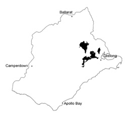 |
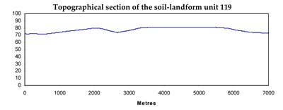
 Gently undulating basalt plain | 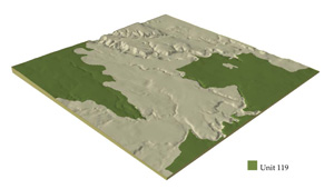 |
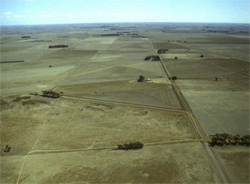
 | 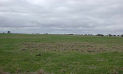 Grazing is a common land use of this soil-landform unit |
Component | 1 | 2 |
Proportion of soil-landform unit | 70% | 30% |
| CLIMATE Rainfall (mm) | Annual: 590 | |
| Temperature (oC) | Minimum 9, Maximum 19 | |
| Precipitation less than potential evapotranspiration | October-April | |
| GEOLOGY Age and lithology | ||
| Geomorphology | ||
| LANDUSE | Uncleared areas: Nature conservation Cleared areas: Sheep and beef cattle grazing; cropping (cereal); softwood plantations | |
| TOPOGRAPHY Landscape | Undulating basalt rises | |
| Elevation range (m) | 19-273 | |
| Local relief (m) | 10 | |
| Drainage pattern | Dendritic | |
| Drainage density (km/km2) | 0.8 | |
| Landform | Rises | Plain |
| Landform element | Undulating stony rises | Flats/depressions |
| Slope and range (%) | 3 (1-5) | 1 (0-3) |
| Slope shape | Convex | Straight |
| NATIVE VEGETATION Ecological Vegetation Class | Plains Grassland (0.3%) | |
| SOIL Parent material | Basalt | Basaltic colluvium and alluvium |
| Description (Corangamite Soil Group) | Neutral and alkaline shallow self-mulching clays (39) | Alkaline deep or shallow grey cracking clays (39) |
| Soil type sites | ||
| Surface texture | Light clay | Light clay |
| Permeability | Low | Very low |
| Depth (m) | >2 | >2 |
| LAND CHARACTERISTICS, POTENTIAL AND LIMITATIONS | Uniform expansive clay soil, high water holding capacity and nutrient holding capacity. Shallow soil, stones common. Cracking soil, black soil may have self-mulching surfaces. Low to moderate permeability once moist, sodic (often strongly) subsoil. Slow site drainage. | Uniform expansive clay soil, high to very high water holding capcity and nutrient holding capacity. Deep, few stones. Cracking soil, black soil may have self-mulching surfaces where it occurs. Low permeability once moist, sodic (often strongly) subsoi. Very slow site drainage. |
© State of Victoria (Agriculture Victoria) 1996 - .

This work, Victorian Resources Online, is licensed under a Creative Commons Attribution 4.0 licence. You are free to re-use the work under that licence, on the condition that you credit the State of Victoria (Agriculture Victoria) as author, indicate if changes were made and comply with the other licence terms.
The licence does not apply to ‘branding’ or some ‘images or photographs’ that may be owned by third parties. We ask you to seek prior approval to use images using the VRO feedback form. Access to higher quality images can also be provided on request.
This page was last updated on .