
Soils on Granitic Terrain
Dgh - Slopes with Duplex Soils on Devonian Granite | Dgg - Plains and Rises with Duplex Soils on Devonian Granite
Dgg - Plains and Rises with Duplex Soils on Devonian Granite
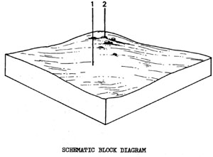 | Plains and rises on granite located at and to the north of Lilydale House, Dog Rocks. These are three areas, totalling 3.3 km2, or 0.5% of the Shire. The rises usually have granite outcrops and tore on the upper slopes and crest. The lower slopes are much gentler. The wash from this land system, being sandy, may influence the topsoil texture of surrounding land systems. The main land use is grazing but there is a flora and fauna reserve at Lilydale House, Dog Rocks. This Boil has a particular susceptibility to Boneseed (Chrysanthemoides monilifera) infestations. SOILS The most common soil type is that of Component 1. |
Mottled Brown Duplex Soils
Factual Key: Dy 3.42/sandy loam, 25-50 cm/granite 100-200 cm
Horizon | Depth (cm) | Description |
A1 | 0-25 | Dark brown (10YR 3/3) when moist; sandy loam; apedal and massive; consistence when slightly moist is firm; pH 5.5; clear boundary. |
A2 | 25-35 | Dull yellow orange (10YR 6/3) when moist; clayey coarse sand; apedal and massive; consistence when slightly moist is loose; pH 7.0; abrupt boundary. |
35-50+ | Bright brown (7.5YR 5/8) when moist; with red mottles; medium clay; strong angular blocky 2 mm; consistence when moist is firm; moderate dispersibility and slaking; pH 7.5. |
| COMPONENT Proportion % | 1 60 | 2 40 |
| CLIMATE | ||
| Rainfall(av.) mm | Annual 510 – 560 | |
| Temperature(av.) °C | Annual 13 | |
| GEOLOGY | ||
| Age, rock | Devonian granite | |
| TOPOGRAPHY | ||
| Landscape | Three isolated occurrences of undulating terrain on the south-eastern border | |
| Elevation (range) m | 30-99 | |
| Local relief (av.) m | 35 | |
| Drainage pattern | Dendritic | |
| Drainage density km/km2 | 1.3 | |
| Land form | Plain | Rise with tore on crest |
| Position on land form | Lower slope | Upper slope |
| Slope (range) %, slope shape | 1-; Straight | 3-10 ; Convex |
| NATIVE VEGETATION | ||
| Structure | Woodland ? | |
| Dominant species | E. leucoxylon | |
| SOIL | ||
| Parent material | In-situ weathered rock | |
| Description | Mottled brown duplex soils | Shallow mottled brown duplex soils |
| Factual key | Db 2.22 | Db 2.22 |
| Surface texture | Sandy loam | Sandy loam |
| Permeability | Moderate | Moderate |
| Depth (range) m | 1.0 - 2.0 | 0.3 - 1.0 |
| LAND USE | ||
Grazing | ||
| SOIL DETERIORATION | ||
| Critical land features | Slope position | Slope gradient, hard setting surfaces |
| Processes | Surface runoff | Surface flow |
| Forms | Minor sheet erosion | Moderate sheet and rill erosion |
Dgh - Slopes with Duplex Soils on Devonian Granite
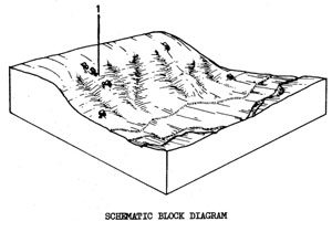 | Moderate slopes cut in the granite plains by Sutherland Creek and Moorabool River at "Darriwill", Hope's Bridge. There are only three small areas, comprising 0.1 km2 in total, or 0.0296 of the Shire. The slopes often have huge granitic outcrops and the depth of soil varies from a few centimetres to over a metre in some places. The mottled brown, duplex soils will rill and gully readily if the vegetative cover is damaged, particularly in areas which receive surface runoff from the granite plains. SOILS The soil occurs in patches between the rock. Where the soils are very shallow, only the A horizons may be present. The description refers to deeper profiles. |
Mottled Brown Duplex Soils - Coarse Structure
Factual Keys Db 2.22/SCL, 5-20 cm/granite
Horizon | Depth (cm) | Description |
A1 | 0-15 | Dark brown (10YR 3/3) when moist, sandy clay loam; hydrophobic; apedal and massive; consistence when dry is hard; pH 6.0; abrupt boundary. |
A2 | 15-35 | Dull yellowish brown (10YR 4/3) when moist; sandy clay loam; apedal and massive; consistence when dry is hard; pH 6.0; abrupt boundary. |
B | 35-60+ | Brown (10YR 4/6) with red mottles, clay; coarse primary structure breaking down to a find angular blocky structure 2 mm; consistence when moist is firm; clay slakes rapidly when wetted; pH 7.0. |
| COMPONENT Proportion % | 1 100 |
| CLIMATE | |
| Rainfall(av.) mm | Annual 510 – 560 |
| Temperature(av.) °C | Annual 13 |
| GEOLOGY | |
| Age, rock | Devonian granite |
| TOPOGRAPHY | |
| Landscape | Gentle scarps at Darriwill area |
| Elevation (range) m | 46 - 61 |
| Local relief (av.) m | 15 |
| Drainage pattern | Dendritic |
| Drainage density km/km2 | 1.4 |
| Land form | Scarps with tore |
| Position on land form | - |
| Slope (range) %, slope shape | 10-20 ; Straight |
| NATIVE VEGETATION | |
| Structure | Woodland ? |
| Dominant species | E. leucoxylon |
| SOIL | |
| Parent material | In-situ weathered rock |
| Description | Mottled brown duplex soils, coarse structure |
| Factual key | Db 2.22 |
| Surface texture | Sandy loam |
| Permeability | Moderate |
| Depth (range) m | 0.5 - 1.2 |
| LAND USE | |
Grazing | |
| SOIL DETERIORATION | |
| Critical land features | Slope gradient, dispersibility |
| Processes | Sub-surface and overland flow |
| Forms | Moderate gully and sheet erosion |
© State of Victoria (Agriculture Victoria) 1996 - .

This work, Victorian Resources Online, is licensed under a Creative Commons Attribution 4.0 licence. You are free to re-use the work under that licence, on the condition that you credit the State of Victoria (Agriculture Victoria) as author, indicate if changes were made and comply with the other licence terms.
The licence does not apply to ‘branding’ or some ‘images or photographs’ that may be owned by third parties. We ask you to seek prior approval to use images using the VRO feedback form. Access to higher quality images can also be provided on request.
This page was last updated on .