
Soils on Granitic Terrain
Dgb - Devonian Granite - Gentle | Dgn - Devonian Granite | Dgt - Devonian Granite - Steep
Dgb - Devonian Granite - Gentle
 | This unit is more gently sloping than the nearby Dgt unit. The unit covers 4.2 km2 or 0.45% of the survey area. The vegetation consists of E. ovata (swamp gum) being associated with E. viminalis (mannagum). Most of the area is cleared and used for grazing sheep and cattle. |
DGB Red Mottled Brown Duplex Soils
Factual Key Db 2.42/SCL-LS, 15-45/granite, 100-200
Horizon | Depth (cm) | Description |
A1 | 0-25 | Brownish black (10YR 3/2) when moist; sandy clay loam; apedal & massive; consistence when dry is hard; pH 6.0; diffuse boundary. |
A2 | 25-35 | Dull yellowish brown (10YR 5/3) when moist; loamy sand; apedal & masssive; consistence when dry is hard; pH 6.0; abrupt boundary. |
B | 35-110 | Brown when moist; few & faint red mottles; heavy clay; moderate angular blocky 3 mm; consistence when slightly moist is firm; pH 6.5; clear boundary. |
BC | 110-200+ | Dull yellowish brown (10YR 5/4) when moist; common & distinct red mottles; sandy clay; weak angular blocky 2 mm; consistence when slightly moist is firm; pH 7.0. |
| COMPONENT Proportion % | 1 |
100 | |
| CLIMATE | |
| Rainfall(av.) mm | 500 – 560 |
| Temperature(av.) °C | - |
| Seasonal growth limitations | - |
| GEOLOGY | |
| Age, rock | Devonian granodiorite |
| TOPOGRAPHY | |
| Landscape | Gentle, sloping terrain |
| Elevation (range) m | 394 – 420 |
| Local relief (av.) m | 10 |
| Drainage pattern | Dendritic |
| Drainage density km/km2 | 0.3 |
| Land form | Plains |
| Position on land form | - |
| Slope (range) %, slope shape | 3 – 6; Convex |
| NATIVE VEGETATION | |
| Structure | Open forest |
| Dominant species | E. ovata, E. viminalis |
| SOIL | |
| Parent material | In-situ weathered rock |
| Description | Red mottled brown duplex soil, coarse structure |
| Surface texture | Sandy loam |
| Permeability | Moderate – low |
| Depth (range) m | 1.5 |
| LAND USE | |
Grazing | |
| SOIL DETERIORATION | |
| Critical land features | Hard setting surfaces, slopes |
| Processes | Overland flow |
| Forms | Sheet & gully erosion |
Dgn - Devonian Granite
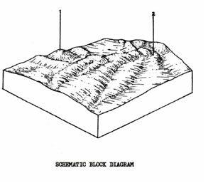 | There is only one small location of this it within the survey area and that is on the west side of Hopwoods Hill, north-west of Mt. Egerton. The unit is used for grazing. It covers about 0.2 km2 or .02% of the survey area. |
DGN Red Mottled, Yellow Duplex Soils
Factual Key Dy 3.41/COSL-SCL, 20-60/Weathered granite, 80-200
Horizon | Depth (cm) | Description |
A1 | 0-10 | Brownish black (10YR 2/2) when moist; coarse sandy clay loam; apedal & massive; consistence when dry is hard; pH 5.5; sharp boundary. |
A2 | 10-50 | Dull yellowish brown (10YR 5/3) when moist; coarse sandy clay loam; apedal & massive; consistence when dry is hard; pH 5.8; sharp boundary. |
| Sometimes just above the B horizon, there is a hard cemented layer or yellow layer (A3) of the same texture as the A2. | ||
B | 50-100+ | Yellowish brown (10YR 5/8) when moist; clay mottled red; strong angular blocky 2 mm; consistence when dry is hard; pH 6.0. |
| COMPONENT Proportion % | 1 | 2 |
30 | 70 | |
| CLIMATE | ||
| Rainfall(av.) mm | 500 – 560 | |
| Temperature(av.) °C | - | |
| Seasonal growth limitations | - | |
| GEOLOGY | ||
| Age, rock | Devonian, granite, granodiorite | Quaternary; wash-gravel sand and clay |
| TOPOGRAPHY | ||
| Landscape | Hilly and rolling country in the centre, south of the Shire | |
| Elevation (range) m | 520 | |
| Local relief (av.) m | 30 | |
| Drainage pattern | Dendritic | |
| Drainage density km/km2 | 4.8 | |
| Land form | Hill | Fan and terrace |
| Position on land form | Crest and slope | Drainage line |
| Slope (range) %, slope shape | 2 – 10; Convex | 1 – 3; Straight |
| NATIVE VEGETATION | ||
| Structure | Open forest | |
| Dominant species | E. viminalis, E. radiata | E. ovata, E. obliqua, E. radiata |
| SOIL | ||
| Parent material | In-situ weathered rock | Unconsolidated wash |
| Description | Red mottled yellow duplex soil | |
| Surface texture | Sandy loam | |
| Permeability | Moderate | Moderate – Low |
| Depth (range) m | 1 | 1 |
| LAND USE | ||
| Soil and gravel stripping | ||
Grazing | ||
| SOIL DETERIORATION | ||
| Critical land features | Moderate slope, low permeability, hard setting surfaces | Poor drainage, low permeability, hard setting surfaces, dispersible soils |
| Processes | Overland flow, subsurface low, deep seepage, leaching of salts | Accumulation of salts, overland flow and waterlogging, subsurface flow |
| Forms | Rill & gully erosion | Salting, gully erosion, compaction |
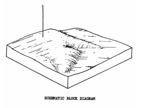
Dgt - Devonian Granite - Steep
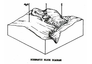 | This unit consists mainly of granodiorite scarps along the Werribee River at Ingliston. The unit covers 2.6 km2 or 0.28% of the survey area. It is presently used for grazing but needs careful management to prevent erosion. The steep slopes and erodible soils are major limitations to any more intensive use than grazing. |
DGT Brown Sand Soils Uniform Texture
Factual Key Uc 2.33/LS. 50-100/Granite, 200+
Horizon | Depth (cm) | Description |
A1 | 0-20 | Dark brown (10YR 3/3) when moist; loamy sand; apedal & massive; consistence when slightly moist is friable; pH 5.5; clear boundary. |
A2 | 20-70 | Dull yellowish brown (10YR 4/3) when moist; loamy sand; apedal & massive; consistence when slightly moist is friable; pH 6.0; abrupt boundary. |
B21 | 70-140 | Brownish black (10YR 3/2) when moist with abundant prominent grey mottles; apedal & massive; consistence when dry is very hard; abundance of prominent grey mottles 3 mm; hard accumulation (hard pan) of coffee rock; clear boundary. |
B22 | 180+ | Yellowish brown (10YR 5/6) when moist; sand; apedal & massive; consistence when slightly moist is friable. |
| COMPONENT Proportion % | 1 | 2 |
95 | 5 | |
| CLIMATE | ||
| Rainfall(av.) mm | 500 – 560 | |
| Temperature(av.) °C | - | |
| Seasonal growth limitations | - | |
| GEOLOGY | ||
| Age, rock | Devonian granodiorite | |
| TOPOGRAPHY | ||
| Landscape | Granodiorite scarps along the Werribee River in the Ingliston area | |
| Elevation (range) m | 243 – 360 | |
| Local relief (av.) m | 50 | |
| Drainage pattern | Dendritic | |
| Drainage density km/km2 | 2.6 | |
| Land form | Slopes & Scarps | Depression line |
| Position on land form | - | - |
| Slope (range) %, slope shape | 15 – 35; Convex | 1 – 3; Straight |
| NATIVE VEGETATION | ||
| Structure | Open forest (?) | |
| Dominant species | E. viminalis | |
| SOIL | ||
| Parent material | In-situ weathered rock | Unconsolidated alluvium sands & clays |
| Description | Brown sand soil, uniform texture | Dark greyish brown duplex soil, coarse structure |
| Surface texture | Sandy loam | Sandy loam |
| Permeability | High | Moderate |
| Depth (range) m | 1 | 1.5 |
| LAND USE | ||
Grazing | ||
| SOIL DETERIORATION | ||
| Critical land features | Slopes | Hard setting surfaces |
| Processes | Overland flow | Overland flow, sub-surface flow |
| Forms | Sheet erosion | Gully, sheet and tunnel erosion |
© State of Victoria (Agriculture Victoria) 1996 - .

This work, Victorian Resources Online, is licensed under a Creative Commons Attribution 4.0 licence. You are free to re-use the work under that licence, on the condition that you credit the State of Victoria (Agriculture Victoria) as author, indicate if changes were made and comply with the other licence terms.
The licence does not apply to ‘branding’ or some ‘images or photographs’ that may be owned by third parties. We ask you to seek prior approval to use images using the VRO feedback form. Access to higher quality images can also be provided on request.
This page was last updated on .