
Soils on Quaternary Unconsolidated Sediments
Qaf - Alluvial Fans - Fault Outwash | Qde - Depressions | Qya - Alluvium - Variable Soils |Q ym - Alluvium - Variable Soils (moist)
Qya - Alluvium - Variable Soils
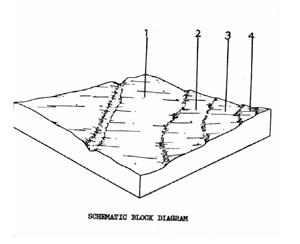 | This unit consists of river deposits of gravel, sand, silts and clays along the main streams in the Shire. It is a very similar unit to Qym but has been 'separated from that unit on the basis of its drier climate. There are up to four terraces with the soil profile becoming more differentiated (i.e. duplex) with distance away from the streams. The unit is mainly used for grazing with occasional fodder crops. Waterlogging and flooding hazard limit other uses. The unit occupies 3.6% of the Shire and covers 33.0 km2. Being a variable unit, the 4 components do not appear throughout the System in a repeated pattern. There may be areas where only some of the components are present. SOILS The soils of component 1 (the most common component) are extremely variable ranging from sands to clays. As no meaningful soil description can be given at this scale, the description that follows is for duplex soils of a higher terrace. |
Red Mottled Yellow Duplex Soils
Factual Key: Dy 3.41/CL, 15-40/Recent alluvium, 70-150
Horizon | Depth (cm) | Description |
A1 | 0-10 | Dark brown (10YR 3/4) when moist; clay loam; apedal & massive; consistence when slightly moist is friable; pH 6.8; clear boundary. |
A21 | 10-20 | Dull yellowish brown (10YR 5,/3) when moist; sandy clay loam; apedal & massive; consistence when slightly moist is friable; pH 6.3; diffuse boundary. |
A22 | 20-25 | Gravelly layer. |
B | 25-100 | Bright yellowish brown (10YR 6/8) when moist; with abundant distinct red mottles; medium clay; strong angular blocky 40 mm breaking down to a angular blocky 2 mm; consistence when slightly moist is firm; pH 5.3. |
C | 100+ | Alluvial deposits - stratified clays, sands and gravel. |
| COMPONENT Proportion % | 1 | 2 | 3 | 4 |
91 | 3 | 3 | 3 | |
| CLIMATE | ||||
| Rainfall(av.) mm | 500 - 760 | |||
| Temperature(av.) °C | - | |||
| Seasonal growth limitations | - | |||
| GEOLOGY | ||||
| Age, rock | Quaternary; river deposits, gravels, sands & clays | |||
| TOPOGRAPHY | ||||
| Landscape | Alluvium of the southern creeks of the Shire | |||
| Elevation (range) m | 321 | |||
| Local relief (av.) m | 1 - 3 | |||
| Drainage pattern | - | |||
| Drainage density km/km2 | 3.3 | |||
| Land form | Terrace 1 | Terrace 2 | Terrace 3 | Terrace 4 |
| Position on land form | - | - | - | - |
| Slope (range) %, slope shape | 1 – 2; Straight | 1 – 2; Straight | 1 – 2; Straight | 1 – 4; Straight |
| NATIVE VEGETATION | ||||
| Structure | Woodland (?) | |||
| Dominant species | E. viminalis, E. radiata | |||
| SOIL | ||||
| Parent material | Unconsolidated gravel, sand, silt and clay | |||
| Description | Dark brown soil, Uniform texture (variable) | Yellow brown duplex soil | Yellow duplex soil, coarse structure | Yellow duplex soil |
| Surface texture | Fine sandy clay loam | Sandy clay loam | Medium sandy clay loam | Clay loam |
| Permeability | Moderate – Low | Moderate – Low | Moderate – Low | Moderate – Low |
| Depth (range) m | 2 | 2 | 2 | 2 |
| LAND USE | ||||
Grazing | ||||
| SOIL DETERIORATION | ||||
| Critical land features | Low lying areas receiving drainage | Low permeability, weak surface structure, hard setting surface | ||
| Processes | Waterlogging, overland flow | Overland flow; movement of salts, subsurface flow, waterlogging | ||
| Forms | Stream bank erosion, gully erosion | Stream bank erosion, gully erosion, compaction | ||
Qaf - Alluvial Fans - Fault Outwash
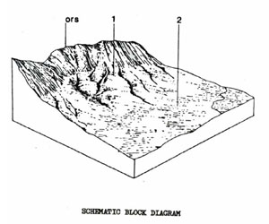 | This unit consists of colluvial and alluvial outwash of gravel and sandy material from the Rowsley Fault along the eastern boundary of the Brisbane Ranges. The unit forms 0.1 of the survey area or 1.0 km2. It is used mainly for grazing and some cereal cropping. The area is highly erodible and needs careful management. SOILS As the soils are a product of wash from the Rowsley Fault Scarp, the upper slopes often have soils consisting of a number of unrelated alluvial/ colluvial layers. A Typical Soil Profile is as follows: |
Brown Shallow Uniform Soils - Weak Structure
Factual Key Uc 1.25/LFS, 10-40/Alluvium Colluvium, 10-40
Horizon | Depth (cm) | Description |
D1 | 0-35 | Dark brown (10YR 3/4) when moist; loamy fine sand; apedal single grained; consistence when slightly moist is loose; pH 6.0; clear boundary. |
D2 | 35-50 | Dull yellowish brown (10YR 8/3) when moist; loamy fine sand; weak sub-angular blocky 10 mm; consistence when slightly moist is loose; soft accumulations of organic matter 2%; pH 7.0; clear boundary. |
D3 | 50-60 | Brownish black (10YR 3/2) when moist; silty clay loam; moderate sub-angular blocky 4 mm; consistence when slightly moist is friable; soft accumulations of organic matter 2%; pH 7.5; clear boundary. |
D4 | 60-90 | Brownish black (7.5YR 3/1) when moist; clay; moderate sub-angular blocky 3 mm; consistence when dry is hard; pH 7.5; diffuse boundary. |
D5 | 90-200 | Brownish black (10YR 3/2) when moist; faint distinct yellow mottles; silty clay loam; moderate sub-angular blocky 2 mm; consistence when dry is very hard; soft accumulations of organic matter 1%; pH 8.5. |
| COMPONENT Proportion % | 1 | 2 |
60 | 40 | |
| CLIMATE | ||
| Rainfall(av.) mm | 500 – 610 | |
| Temperature(av.) °C | - | |
| Seasonal growth limitations | - | |
| GEOLOGY | ||
| Age, rock | Quaternary fault aprons, gravel, sand | |
| TOPOGRAPHY | ||
| Landscape | Gently sloping, plain off the Rowsley fault | |
| Elevation (range) m | 240 | |
| Local relief (av.) m | 7 | |
| Drainage pattern | Parallel | |
| Drainage density km/km2 | 1.2 | |
| Land form | Plain | |
| Position on land form | Upper slope | Lower slope |
| Slope (range) %, slope shape | 2 – 6 | 1 - 3 |
| NATIVE VEGETATION | ||
| Structure | Open forest | |
| Dominant species | E. microcarpa, E. leucoxylon, E. polyanthemos, E. goniocalyx, E. ovata | |
| SOIL | ||
| Parent material | Unconsolidated sediments | |
| Description | Brown shallow uniform soil, weak structure | Red duplex soil, coarse structure, sodic |
| Surface texture | Clay loam | Clay loam |
| Permeability | Moderate | Low |
| Depth (range) m | 0.5 | 2 |
| LAND USE | ||
Grazing, some cereal cropping | ||
| SOIL DETERIORATION | ||
| Critical land features | Structure, dispersibility, permeability, slope | |
| Processes | Overland flow, sub-surface flow, movement of salts | |
| Forms | Sheet, rill, gully, tunnel erosion | |
Qde - Depressions
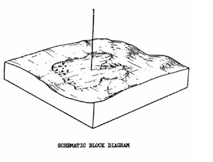 | This unit consists of swamps and depressions mainly in the central and southern parts of the Shire. The unit covers 0.85% of the survey area or 7.9 km2. It is presently used for grazing with some cereal cropping in dry years. The tendency to waterlogging particularly in winter limits more intensive use of these areas. |
QDE Black Uniform Texture Soils Coarse Structure
Factual Key Ug 5.1/C, 20/Variable (generally basalt), 100+
Horizon | Depth (cm) | Description |
A | 0-20 | Brownish black (7.5YR 212) when moist with bright brown rootline oxidation; light medium clay; strong angular blocky 3 mm; pH 6.0; diffuse boundary. |
B | 20-100+ | Brownish black (10YR 2/2) when moist; medium clay; strong angular blocky 10 mm; consistence when wet is very plastic; pH 6.0. |
| COMPONENT Proportion % | 1 |
100 | |
| CLIMATE | |
| Rainfall(av.) mm | 635 – 711 |
| Temperature(av.) °C | - |
| Seasonal growth limitations | - |
| GEOLOGY | |
| Age, rock | Recent sands, silts and clays |
| TOPOGRAPHY | |
| Landscape | Swamp & depressions in centre & south of area |
| Elevation (range) m | 121 |
| Local relief (av.) m | 1 |
| Drainage pattern | - |
| Drainage density km/km2 | - |
| Land form | Swamp and depressions |
| Position on land form | - |
| Slope (range) %, slope shape | 1; Flat |
| NATIVE VEGETATION | |
| Structure | Woodland |
| Dominant species | E. ovata |
| SOIL | |
| Parent material | Unconsolidated sands, silts & clays |
| Description | Mottled dark grey, yellow gradational soil & black clay soil, uniform texture, coarse structure |
| Surface texture | Light clay/clay |
| Permeability | Low |
| Depth (range) m | 2 |
| LAND USE | |
Grazing, occasional cropping (cereal) | |
| SOIL DETERIORATION | |
| Critical land features | Slowly permeable soils |
| Processes | Waterlogging |
| Forms | Compaction |
Qym - Alluvium - Variable Soils (moist)
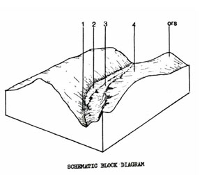 | This unit consists of alluvial terraces in the wetter northern part of the survey area. The unit comprises 0.5% of the Shire and covers 4.7 km2. There are up to four terraces each with different soils. Some of these terraces are subject to flooding which limits their use for anything other than grazing. Some parts of this unit are forested and there has also been some gold mining. |
QYM Dark Yellowish Brown Gradational Soils
Factual Key Gn 2 /CL, 25-35/Alluvium, 200+
Horizon | Depth (cm) | Description |
A | 0-50 | Dark brown (10YR 3/4) when moist; clay loam; weak sub-angular blocky 5 mm; consistence when slightly moist is friable; pH 6.0 gradual boundary. |
B | 30-200 | Brown (7.5YR 4/6) when moist; with few faint red mottles; light clay; weak sub-angular blocky 5 mm; consistence when slightly moist is friable; pH 6.0. |
| COMPONENT Proportion % | 1 | 2 | 3 | 4 |
30 | 40 | 25 | 5 | |
| CLIMATE | ||||
| Rainfall(av.) mm | 810 – 915 | |||
| Temperature(av.) °C | - | |||
| Seasonal growth limitations | - | |||
| GEOLOGY | ||||
| Age, rock | Quaternary river deposits, gravels, sands & clays | |||
| TOPOGRAPHY | ||||
| Landscape | Alluvium of northern creeks of the Shire | |||
| Elevation (range) m | 450 – 600 | |||
| Local relief (av.) m | 4 | |||
| Drainage pattern | - | |||
| Drainage density km/km2 | - | |||
| Land form | Terrace 1 | Terrace 2 | Terrace 3 | Terrace 4 |
| Position on land form | - | - | - | - |
| Slope (range) %, slope shape | 1 – 2; Straight | 1 – 2; Straight | 1 – 2; Straight | 1 – 3; Convex |
| NATIVE VEGETATION | ||||
| Structure | Open forest | |||
| Dominant species | E. viminalis, E. melanoxylon | E. obliqua, E. ovata | ||
| SOIL | ||||
| Parent material | Unconsolidated river deposits | |||
| Description | Variable, uniform sands & gravels | Dark yellowish brown gradational soils | Brown gradational soils | Yellow duplex soils |
| Surface texture | Sand | Clay loam | Clay loam | Clay loam |
| Permeability | High | High | High | High |
| Depth (range) m | >1 | 1.5 | 2 | 1.5 |
| LAND USE | ||||
Grazing, recreationForestry, grazing, recreation, some urban subdivision, mining (past) | ||||
| SOIL DETERIORATION | ||||
| Critical land features | Low lying areas | Hard setting surfaces | ||
| Processes | Overland flow & regular flooding | Overland flow, subsurface flow | Overland flow | |
| Forms | Stream bank erosion, gully erosion | Stream bank erosion, gully erosion | Sheet erosion, compaction | |
© State of Victoria (Agriculture Victoria) 1996 - .

This work, Victorian Resources Online, is licensed under a Creative Commons Attribution 4.0 licence. You are free to re-use the work under that licence, on the condition that you credit the State of Victoria (Agriculture Victoria) as author, indicate if changes were made and comply with the other licence terms.
The licence does not apply to ‘branding’ or some ‘images or photographs’ that may be owned by third parties. We ask you to seek prior approval to use images using the VRO feedback form. Access to higher quality images can also be provided on request.
This page was last updated on .