3. Outer Barrier - Shallow Inlet to Reeves Beach
|
This information has been developed from the publications:
|
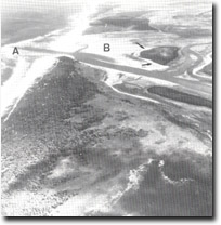
| Location: | 855190 to 955300. This site includes the outer barrier and ocean beach north-east of Shallow Inlet, Shoal Inlet and the tidal channel and adjacent wetlands that extend from McLoughlans beach to Reeves Beach. |  'New Entrance' near McLoughlans Beach. Ebb delta, (A), flood delta, (B), sand cheniers, (arrowed), invading mangrove island. |
Access: | McLoughlans beach Road and Reeves Beach Road. | |
Ownership: | Mainly Crown Land along the ocean coast and private land along the inlet shoreline. | |
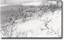
Geology/Geomorphology: | This large site includes a barrier island segment north-east of Shallow Inlet entrance, the “New Entrance” opposite St. Margaret Island, a broad sector of multiple beach ridges north-east of this entrance and a shallow tidal channel system. Of particular interest is the “New Entrance” across the outer barrier near McLoughlans Beach which was opened by wave action in June 1961. The entrance has remained open since that time and ebb and flood tide deltas have developed on either side of the inlet throat. The entrance has admitted a considerable amount of sand into the tidal system which has admitted a considerable amount of sand into the tidal system which has spread onto the mangrove islands and southern shores of St. Margaret Island. Sand beaches and cheniers have thus replaced mangrove swamps along part of this shoreline. East of McLoughlans Beach, the tidal system is confined to a single meandering channel. The few mangroves that fringe this channel represent the easternmost occurrence of this species on the Victorian coast. The outer barrier east of the New Entrance consists of parallel beach ridges, (up to fourteen opposite McLoughlans Beach), which have been little modified by transgressive dunes. The oblique alignment of these ridges near the New Entrance indicates the degree of shoreline recession that has occurred in the late Holocene, resulting eventually in the breaching of the entrance. | |
Significance: | National. The growth, erosion and ultimate breaching of the outer barrier (as represented by the configuration of the barrier at this site) is a major example of the mode of formation and modification of barrier systems. Continued monitoring of the changes in the barrier form and in the rate of accretion of the new tidal deltas will yield important data about the nature of sediment movement and emplacement on a barrier shoreline. Given the complexity of this process, this is a site of particular value to coastal geomorphologists. | |
Management: | Subdivision of the barrier dunes for residential or other building development should be prohibited. Dredging or widening of the New Entrance should not be permitted as this would allow further ingress of sand into the inlet and hasten the destruction of the mangrove shores. | |
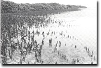
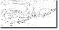
 Vigorous mangrove growth on sheltered shoreline - St. Margaret Island. |  Mangrove die-back due to sand burial opposite 'New Entrance', (arrowed), near McLoughlans Beach. |  Outer barrier ridges and tidal lagoon east of McLoughlans Beach. Mangroves, (arrowed), are the easternmost stand occurring on the Victorian coast. |


