Your gateway to a wide range of natural resources information and associated maps

Victorian Resources Online

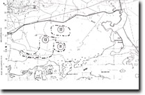
12. Dunes, Swamp, Ridges - Gelliondale

This information has been developed from the publications:

  • Sites of Geological and Geomorphological Significance in Central Gippsland (1981) by Neville Rosengren, M.S McRae-Williams and S.M Kraemers,
  • Sites of Geological and Geomorphological Significance on the Coast of Port Phillip Bay and in the Catchment of Westernport Bay (1984, 88) by Neville Rosengren.
  • Sites of Geological and Geomorphological Significance in the South Gippsland Marine and Coastal Parks (1989) by Neville Rosengren.
Geological heritage sites, including sites of geomorphological interest and volcanic heritage sites, are under regular revision by the Geological Society of Australia, especially in the assessment of significance and values. Reference should be made to the most recent reports. See the Earth Science Heritage (external link) section of the Geological Society of Australia website for details of geological heritage reports, and a bibliography.

Location:630225. Four kilometres south of Gelliondale.

Access:
Pearsons Road.

Ownership:
Crown Land.

Geology/Geomorphology:
Several swamps and small lakes have well developed arcuate ridges on their eastern margin.

Significance:
Regional. The swamps have been relatively little modified by drainage or grazing. They represent the best preserved working example of the process that has formed the larger drained swamplands and inactive “lunette” ridges in the Gelliondale – Welshpool area.

Management:
Drainage or other excavation work on the swamps and associated ridges should be prohibited.

Page top