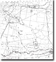
43. Fells Creek - East of Toongabbie
|
This information has been developed from the publications:
|
| Location: | 670895 to 715866. Fells Creek between Back Cowwarr Road bridge and Toongabbie – Kilmany Road. | |
Access: | Cowwarr Road, Kilmany Road. | |
Ownership: | Private Land. | |
Geology/Geomorphology: | Fells Creek is deeply gullied downstream from Back Cowwarr Road bridge for a distance of five kilometres. Sediment eroded from this sector is subsequently deposited as channel bars and flood plain fans near the Kilmany – Toongabbie Road. Drainage works are necessary to maintain river flow and reduce flood risk. | |
Significance: | Regional. The erosion and deposition dates from the 1890’s, following artificial channel straightening and drainage diversion in the catchment of Fells Creek. The site clearly demonstrates the problems created by these earlier works. | |
Management: | Because public and private property is at risk due to continued erosion and deposition, management strategies must primarily consider methods to reduce that risk. | |
References: | Bird, E.C.F., Bird, J.F., Finlayson, B.L., McArthur, J.A. and Mckay, J.M. 1979. Bank Erosion on the Latrobe River and its Lower Tributaries. Publication No. 267, Environmental Studies Series, Ministry for Conservation, Victoria. | |


