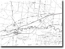
39. Snake Ridge
|
This information has been developed from the publications:
|
| Location: | 780780 to 930830. North of the Princes Highway between Rosedale and Kilmany. | |
Access: | Princes Highway; Rosedale-Heyfield Road; Maffra-Rosedale Road. | |
Ownership: | Private Land. | |
Geology/Geomorphology: | North of the La Trobe River near Rosedale is a broad ridge formed by the Snake Ridge Monocline. This ridge is breached near Kilmany by the alluviated valley of the Nambrok Creek (Snake Ridge Gap) and is a point where previously the Thomson River crossed through to join the La Trobe. Low, almost imperceptible ridges (30-60 cms. high) extend to this gap from the north-west and mark the remnants of levee banks of the former Thomson River. Outcrops of Haunted Hill gravels occur in shallow quarries and road cuttings on the Snake Ridge Monocline at 808803 and 832802. A prominent bluff on the northern side of the La Trobe River at 780780 marks the point where the monocline crosses the La Trobe River valley causing partial damming and swamp development upstream. | |
Significance: | State. Snake Ridge is a clear example of a monoclinal structure and associated drainage disruption to the La Trobe River and its tributaries. | |
Management: | Because of the area covered by the site it is unlikely that localised land disturbance can cause serious deterioration of the major features of importance. Roadworks or further quarrying would provide new sections and could enhance the geological interest in the site. | |
References: | Jenkin, J.J. 1968. The geomorphology and upper Cainozoic geology of south-east Gippsland, Victoria. Mem. geol. Surv. Vict., 27. | |


