
33. Gravel Pit, Merriman Creek
|
This information has been developed from the publications:
|
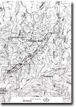
| Location: | 705570. Five kilometres south-west of Gormandale along Merriman Creek. | |
Access: | Quarry face at the side of road. | |
Ownership: | Crown Land. | |
Geology/Geomorphology: | An abandoned gravel quarry exposes a 10 metre section through coarse sand and grits of the Haunted Hill Gravels. Blocks of grey clay up to 6 cm across, and arranged in rough layers are intercalated with coarse sand and clay with some bands of dark grey secondary-silicified, cross-bedded layers. | |
Significance: | Local. | |
Management: | The base of the quarry face should be cleared of undergrowth. The low significance of the site indicates that management strategies should ensure that unrestricted access to the quarry face be maintained. | |
© State of Victoria (Agriculture Victoria) 1996 - .

This work, Victorian Resources Online, is licensed under a Creative Commons Attribution 4.0 licence. You are free to re-use the work under that licence, on the condition that you credit the State of Victoria (Agriculture Victoria) as author, indicate if changes were made and comply with the other licence terms.
The licence does not apply to ‘branding’ or some ‘images or photographs’ that may be owned by third parties. We ask you to seek prior approval to use images using the VRO feedback form. Access to higher quality images can also be provided on request.
This page was last updated on .