18. Bodman Creek Gully
|
This information has been developed from the publications:
|
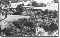
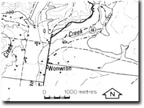
| Location: | 765426. Two kilometres north-east of Wonwron. |  Gully incised into alluvium - Bodman Creek. |
Access: | Unmarked track off Boodyarn Road. | |
Ownership: | Private land. | |
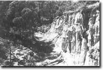
Geology/Geomorphology: | Bodman Creek has a deeply incised channel along a two kilometre section of the stream below the Boodyarn Road bridge. The gullied sector is cut into alluvial (flood plain) deposits, near the bridge and further downstream into ferruginous sandstones and gravels of the Haunted Hill Gravels. | |
Significance: | State. This is one of the deepest natural sections available in the study area that exposes Haunted Hill Gravels. A variety of depositional and weathering structures are clearly displayed. The cause of the rapid incision of the creek along this sector is not fully understood although it may be related to artificial straightening and draining of the channel near Wronron. | |
Management: | The gullied sector that exposes the Haunted Hill Gravels should be left in its present active state. Reclamation works and erosion control measures are necessary to prevent loss of valuable flood plain land to the north and west of the Tertiary exposure. Such works could be undertaken without seriously interferring with the Tertiary outcrop. | |
 Ferruginous sandstone of the Haunted Hill Gravels - Bodman Creek gully. |


