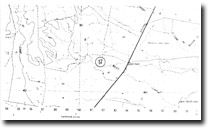
17. Dariman Lime Pit
|
This information has been developed from the publications:
|
| Location: | 915420. Three kilometres west of Darriman. | |
Access: | Boundary Road. | |
Ownership: | Private Land. | |
Geology/Geomorphology: | The Gippsland Limestone of lower to middle Miocene age, is a thick sheet of bryozoal marl and limestone representing the middle part of the marine Tertiary sequence in Gippsland. In the Bruthen Creek – Darriman area, outcrops occur on the upthrown block associated with the Darriman Monocline and are considered to represent the upper section of the lower Miocene deposits. In the Darriman area, limestone outcrops along Morris Creek for approximately one kilometre and is well exposed in the Darriman agricultural lime quarry, where a total thickness of 10 metres of soft, white, marly limestone with numerous shell horizons and a few hard concretionary layers interbedded with occasional marl is exposed above creek level. | |
Significance: | Regional. The exposure is considered to represent the upper section of the lower Miocene deposits of the Gippsland Limestone | |
Management: | The site is at present actively quarried ensuring that fresh exposures are readily observed. If the quarry were closed management procedures with a view to maintaining some clear faces should be implemented. The principles of quarry mangement discussed on page 6 of this report apply at this site. | |
References: | Douglas, J.G. and Ferguson, J.A. (eds.) 91976): Geology of Victoria. Spec. Publ. geol. Soc. Aust.,5. | |


