
16. Carrajung South Road Cutting
|
This information has been developed from the publications:
|
| Location: | 825510. | 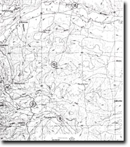 Sites 8221 - 12 to 16 |
Access: | Yarram-Traralgon Road near Carrajung South. | |
Ownership: | Crown Land | |
Geology/Geomorphology: | A large, steep, road-side batter exposes an irregular, unconformable contact between the Haunted Hill Gravels and the upper section of the La Trobe Valley Group. | |
Significance: | Local. The site provides an easily accessible area in which to observe lithological variation within the upper La Trobe Valley Group which consists of white micaceous, often hard clay, silt and silty sand with minor clayey, feldspathic coarse sand, igneous clay and brown coal. | |
Management: | Maintenance of clear exposures in the Yarram-Traralgon Road cutting at this site would enhance the significance of the site. | |
© State of Victoria (Agriculture Victoria) 1996 - .

This work, Victorian Resources Online, is licensed under a Creative Commons Attribution 4.0 licence. You are free to re-use the work under that licence, on the condition that you credit the State of Victoria (Agriculture Victoria) as author, indicate if changes were made and comply with the other licence terms.
The licence does not apply to ‘branding’ or some ‘images or photographs’ that may be owned by third parties. We ask you to seek prior approval to use images using the VRO feedback form. Access to higher quality images can also be provided on request.
This page was last updated on .