
12. Merriman Creek - Willung
|
This information has been developed from the publications:
|
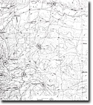
| Location: | 847666. Bridge over Merriman Creek at Willung. | |
Access: | Old Rosedale Road. | |
Ownership: | Private Land. | |
Geology/Geomorphology: | Strongly ferruginised grits and sands of the Haunted Hill Gravels outcrop to form a small spur which has constricted Merriman Creek and resulted in extensive alluviation upstream. | |
Significance: | Regional. This is a clear example of a process which has caused deposition in several Gippsland rivers. | |
Management: | It is recommended that the spur and the ironstone outcrops be maintained as a complete landform unit to clearly illustrate the processes of alluviation involved in Merriman Creek. The small road cutting across the spur leading to the nearby house provides an adequate section into the ferruginous sediments and widening of this cutting could be permitted. | |
References: | Jenkin, J.J. 1968. The geomorphology and upper Cainozoic geology of south-east Gippsland, victoria. Mem. geol. Surv. Vict., 27. | |
© State of Victoria (Agriculture Victoria) 1996 - .

This work, Victorian Resources Online, is licensed under a Creative Commons Attribution 4.0 licence. You are free to re-use the work under that licence, on the condition that you credit the State of Victoria (Agriculture Victoria) as author, indicate if changes were made and comply with the other licence terms.
The licence does not apply to ‘branding’ or some ‘images or photographs’ that may be owned by third parties. We ask you to seek prior approval to use images using the VRO feedback form. Access to higher quality images can also be provided on request.
This page was last updated on .