
11. ARM Quarry - Stradbroke West
|
This information has been developed from the publications:
|
| Location: | 955655. End of Limestone Quarry Road 16 kilometres south-east of Rosedale. | 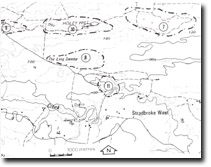 Sites 8221 - 7 to 11 |
Access: | Limestone Quarry Road. | |
Ownership: | Private Land. | |
Geology/Geomorphology: | This large quarry provides a major exposure of beds of the Gippsland Limestone. Because of the depth of the quarry, a variety of calcareous sediments are exposed including several which are richly fossiliferous. | |
Significance: | Regional. This is the best exposure of the Gippsland Limestone currently available. | |
Management: | It is recommended that abandoned quarry faces in the eastern part of the quarry not be filled or otherwise obscured and a representative section of the main limestone deposit should be retained. | |
References: | Hocking, J.B. 1970. Geology of the lower Miocene calcareous deposits in the Sale-Yarram region, South Gippsland. Min. geol. J. Vict., 6(6), pp. 80-90. | |
© State of Victoria (Agriculture Victoria) 1996 - .

This work, Victorian Resources Online, is licensed under a Creative Commons Attribution 4.0 licence. You are free to re-use the work under that licence, on the condition that you credit the State of Victoria (Agriculture Victoria) as author, indicate if changes were made and comply with the other licence terms.
The licence does not apply to ‘branding’ or some ‘images or photographs’ that may be owned by third parties. We ask you to seek prior approval to use images using the VRO feedback form. Access to higher quality images can also be provided on request.
This page was last updated on .