7. Duck Point West
This information has been developed from the publication:
|
| Location | 355042. One kilometre west of Duck Point. Yanakie. |
Access: | Foley Road to Yanakie Beach and walk along coast from Duck Point. |
Significant Features: | This coastal sector is of bluffs and low cliffs with a steep upper beach and an unusually wide shore platform. The cliffs are in bedded, cemented, coarse white sands and fine gravel of the Haunted Hills Formation and directly nourish the steeply sloping high tide beach line. Where the cliffs are inactive, they are fronted by a 3 m to 4 m high sand ridge piled up into Leptospermum scrub. The ridge is more a chenier than a beach ridge and must be built by storms at times of high tide. It is of coarse sand and does not have a capping of aeolian material. |
In several places, the cliff and bluff outcrops are difficult to interpret as the material has the appearance of weathered granite rather than Haunted Hills Formation. Weathered, iron-stained, cemented material at the top of the section grades into "granite-like" rock below without an apparent surface of unconformity. The "granites" include large angular feldspars partly decayed to kaolin. | |
The intertidal area has two features of particular interest. There are linear sand bars lying oblique to the shoreline and large irregular deltaic sand lobes at the mouths of small creeks. Chenier ridges are built from these lobes and invade backing salt marshes. Along the coast is an intertidal platform up to 500 metres wide in the rotted "granitic" material with a thin sand/mud covering. | |
Significance Level: | State. The site is one where there are a number of unusual features. The nature of the sediment/granite material differs from any other outcrop known in South Gippsland and needs more detailed analysis. The height of the beach/chenier storm ridges is also unusual. The shore platform is one of the widest in Victoria. |
Management Issues: | No immediate threats are apparent. Removal of the (seemingly) abundant sand should be prohibited as the sand - shoreline stability balance is probably a fine one. The shore platform materials are relatively fragile and visitors should be educated about damage to this by excessive trampling. Vehicles should not be permitted on the beach or Crown Land area. |
Research & Monitoring Requirements: | The geology and geomorphology of this coastal sector await detailed investigation. The important of sand movement here as a source for the Duck Point foreland and ultimately for Yanakie Beach needs to be determined. |
Public Interpretation Possibilities: | The features would be suitable for interpretation. There are possibilities for a very interesting coastal trail from Townsends Point to Red Bluff traversing this site. |
Main References: | None. |
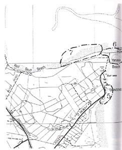 Sites 5 (Townsends Point), 6 (Duck Point) & 7 (Duck Point West) | 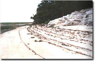 Cliff of Haunted Hill Formation gravel nourishing steep upper beach face west of Duck Point |
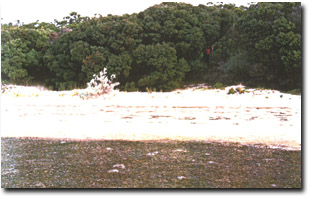 High foredune (chenier) ridge into tea-tree scrub west of Duck Point | 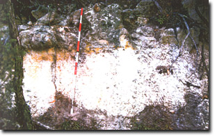 Haunted Hill Formation overlying weathered granite west of Duck Point |
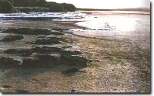 Sands lobes and Haunted Hills Formation outcrop on shore platform west of Duck Point | 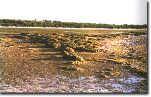 Wide shore platform of Haunted Hill Formation west of Duck Point |


