6. Duck Point
This information has been developed from the publication:
|
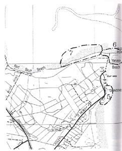
| Location | 367043. Immediately north of the boat launching ramp at Yanakie Beach, Yanakie. |
Access: | Foley Road. |
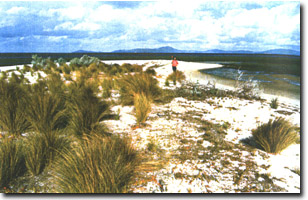
Significant Features: | Duck Point is a tapering foreland built of a succession of parallel beach ridges with a gently recurving distal point. The base of the foreland lies against the bluff that extends inland from Townsends Point (behind the camping ground at Yanakie Beach) but the topography of the basal area has been greatly modified farmland and a refuse disposal site. Only the outer 300 m is substantially intact although there has been some (unauthorised?) removal of beach sand by machinery. |
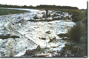
The foreland is composed of coarse granitic sand that is derived from weathered granite and Haunted Hills Formation sands and gravels. It is nourished by drift from two direction and has at least three set of ridges: (a) a group of inner ridges (on private land and largely obliterated); (b) a well-defined sequence of slightly diverging north-south ridges extending north from the boat ramp; (c) an irregular outer ridge group aligned east-west along the apex of the foreland. The ridges of group (b) are beach ridges with little wind-blown sand and are sub-parallel, diverging an truncated at the northern end of Yanakie Beach where they abut the elongated eastward trending spit formed from ride set (c). Although the group (b) ridges have grown partly as a result of northerly drift of sand past Townsends Point, nourishment of these ridges could be mainly from sand originally derived from the west of Duck Point which has been moved along the distal end of Duck Point spit and reworked shorewards. | |
Significance Level: | State. The site is one of the few known on the Victorian coast where there is sustained progradation of a sandy coast. The mechanism of foreland growth is clear and the site is readily accessible. The ridges have grown apparently without wind action and are due to strong wave action at high tide. |
Management Issues: | The main issues are mechanical removal of sand from the foreland and the impact of shore protection works at the boat ramp and camping areas. Sand should not be quarried from this site and vehicle traffic should be excluded from the foreland area. |
Research & Monitoring Requirements: | Determining the pattern and volume of sand movement (both from historical photographs and by short term observations); monitoring of the beach profile to determine the nature and causes of beach changes at various points including Yanakie Beach. |
Public Interpretation Possibilities: | The site is a clear and accessible example of coastal progradation and could easily figure in a public interpretation programme. |
Main References: | Vertical aerial photographs: Corner Inlet Project 1713 Film 3827 run 16 Frame 77-79. |
 Sites 5 (Townsends Point), 6 (Duck Point) & 7 (Duck Point West) |  Recurve at distal end of Duck Point spit |
 Low, wave-built ridges on Duck Point |


