
17. Agnes River
This information has been developed from the publication:
|
| Location | 450182. Mouth of Agnes River 4 km south-east of Toora. |
Access: | Barry Road or by boat. Access from Barry Road involves crossing private property. |
Significant Features: | The site enclosed the sweeping tidal meanders of the lower reaches of the Agnes River. The channel is lined by mangroves and there are areas of Spartina on intertidal flats. |
Significance Level: | Regional. These are the most tortuous tidal meanders of any stream channel entering Corner Inlet and have not been altered by drainage or re-alignment. |
Management Issues: | Channel straightening or drainage would diminish the significance of the site. |
Research & Monitoring Requirements: | Mapping of the Spartina to determine the rate of spread of the introduced grass. |
Public Interpretation Possibilities: | Not applicable. |
Main References: | Vertical aerial photographs. |
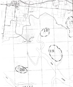
Sites 17 (Agnes River), 18 (Toora Island), 19 (Inter-tidal flats) and 20 (Mangrove Island)
© State of Victoria (Agriculture Victoria) 1996 - 2025.

This work, Victorian Resources Online, is licensed under a Creative Commons Attribution 4.0 licence. You are free to re-use the work under that licence, on the condition that you credit the State of Victoria (Agriculture Victoria) as author, indicate if changes were made and comply with the other licence terms.
The licence does not apply to ‘branding’ or some ‘images or photographs’ that may be owned by third parties. We ask you to seek prior approval to use images using the VRO feedback form. Access to higher quality images can also be provided on request.
This page was last updated on 25/01/2019.