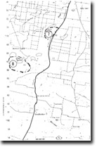
8. Craig Swamp and Lakes
|
This information has been developed from the publications:
|
| Location: | 015666. Seven kilometres north of Stradbroke. |  Sites 8321-7 8 |
Access: | Unformed track off South Gippsland Highway six kilometres north of Stradbroke. | |
Ownership: | Crown Land, some private land. | |
| Geology/Geomorphology: | This area is a mosaic of small lakes and swamps that lie on the uplifted and warped terrace surface north of Merriman Creek. The swamps lie on the same drainage alignment as Long Swamp and at a lower level. They represent a disrupted drainage system that has been developed on older barrier dune sands. | |
Significance: | Regional. The wetlands are representative of the drainage systems on Pleistocene barrier sands in the Holey Plains area. Their evolution is due to upwarping on the Baragwanath Anticline. | |
Management: | Disturbance to the wetlands such as further clearing and drainage should be prohibited. | |
References: | Jenkin, J.J. 1968. The geomorphology and upper Cainozoic geology of south-east Gippsland, Victoria. Mem. geol. Surv. Vict., 27. | |


