
3. Landslips - Limonite
|
This information has been developed from the publications:
|
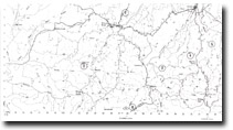
| Location: | 321442; 319438. Two kilometres east of Limonite. | |
Access: | The Grand Ridge Road; Swain road. | |
Ownership: | Private land. | |
Geology/Geomorphology: | Two landslips have developed on the northern and southern slopes of The Grand Ridge east of Limonite. The northern slip is narrow with a semi-circular head and has given rise to a long well-defined earthflow that has blocked a tributary of O’Grady Creek. The southern slip is of broad amphitheatre shape and consists of numerous rotational slides at several levels. Both sides are developed in weathered basalt and probably involve movement at the contact with the underlying cretaceous sediments. | |
Significance/Management: | Regional. Mass movement processes in the South Gippsland Hills - Landslips and Soil Creep | |
© State of Victoria (Agriculture Victoria) 1996 - 2025.

This work, Victorian Resources Online, is licensed under a Creative Commons Attribution 4.0 licence. You are free to re-use the work under that licence, on the condition that you credit the State of Victoria (Agriculture Victoria) as author, indicate if changes were made and comply with the other licence terms.
The licence does not apply to ‘branding’ or some ‘images or photographs’ that may be owned by third parties. We ask you to seek prior approval to use images using the VRO feedback form. Access to higher quality images can also be provided on request.
This page was last updated on 25/01/2019.