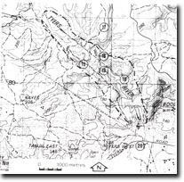
17. Boola Quarry
|
This information has been developed from the publications:
|
| Location: | 497826. Seven kilometres north-west of the Boola Fire Tower. | |
Access: | Extension of Boola Road to Traralgon-Walhalla Road. | |
| Ownership: | Crown Land. | |
Geology/Geomorphology: | Calcarenitic and calcilutitic limestone of the Coopers Creek Limestone is exposed on two levels in Boola Quarry. This limestone is highly jointed with many of the joints filled with calcite. The limestone dips to the west at approximately 40o, a shallower angle than the limestone further to the south in the Tyers River. Fossils are uncommon although examples of stromatoporoid tabulate and rugose corals were noted in the lower quarry area. | |
Significance: | Regional. Although other sites have been designated in the Coopers Creek Limestone, Boola Quarry provides an important fossil locality in an area away from the Tyers River which is poor in outcrop. The limestone also approaches a calcilutite rather than the more common calcarenite. | |
| Management: | Maintenance of clear exposures on the quarry faces would enhance the value of the site. Future, limited quarrying would therefore be of benefit to the site. The quarry management statement on page 6 of this report applies here. | |
References: | Philip,G.M. 1962. The Jurassic sediments of the Tyers Group, gippsland, Victoria. Proc. R. Soc. Vict., 70, pp. 181-199. | |


