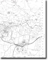
14. Yallourn Quarry
|
This information has been developed from the publications:
|
| Location: | 437803. Yallourn Readymix Quarry. | |
Access: | Quarry Road via Manuells Road. | |
Ownership: | Private Land. | |
Geology/Geomorphology: | The quarry is excavated on five levels exposing sections in prebasaltic sediments (Childers Formation equivalent), Thorpdale Volcanics and Haunted Hills Gravel. Childers Formation equivalent sediments are best exposed at the base of the quarry on the west wall. At this locality coarse unconsolidated sands exhibiting current bedding are interbedded with clays and thin seams of brown coal. The latter contains many large fragments of lignified wood. This formation represents the lower part of the Proteacidites tuberculatus zone which is of early Late Oligocene age. These sediments are overlain by dense non-vesicular olivine basalt (Thorpdale volcanics) which is highly jointed. Semi-vertical joints predominate, although columnar jointing is not well developed. The basalt becomes slightly more vesicular toward the top of the sequence and the vesicles are on occasion filled by carbonate deposits. The basalt is overlain by interbedded sands, clays, and a thin coal seam. The sands are stained brown by limonite which has been leached out along jointlines and has left bleached pipes throughout the upper part of the sandy sequence. | |
Significance: | Regional. There are few localities within the region where a similar geological sequence is displayed. | |
Management: | Continued quarrying of the basalt is of benefit to the site as this maintains clear quarry faces and enhances the display of geological features. | |
References: | Douglas, J.G. and Ferguson, J.A. (eds) 1976. Geology of Victoria. Geological Society of Australia, Special Publication No.5. | |


