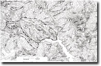
9. Mount Easton Area
This information has been developed from the publications:
|
| Location: | 363285. Seven kilometres west of Aberfeldy. | |
Access: | Thomson-Jordan Divide Road, T-J Divide Road, Mount Easton Track. | |
Ownership: | Crown Land. | |
Geology/Geomorphology: | This site includes the type area of the Jordan River Group. The Group members, McAdam Sandstone and Bullring Siltstone are exposed in road cuttings on the Thomson-Jordan Divide Road and the T-J Divide Road although the type section for the former Formation occurs outside the study area. Shales and slates of the Mount Easton Beds outcrop in numerous fault silvers to the north of Mount Easton. These are highly fossilferous and the graptolite collections from this site form the basis of the definition of the Eastonian stage, the middle stage in the Victorian Late Ordovician | |
Significance: | State. The abundance of graptolites and their use in the definition of the Eastonian Stage of the Ordovician, together with the type sections of the Jordan River Group, indicate the significance of this site. | |
Management: | Because of the area covered by the site it is unlikely that limited land disturbance would detract from the significance of the site. Occasional grading of roadcuttings and limited excavation works would maintain the value of the site. | |
References: | VandenBerg, A.H.M. 1975. Definitions and description of middle Ordovician to middle Devonian rock units of the Warburton district, East Central Victoria. Rep. geol. Surv. Vict., 1975/6. | |


