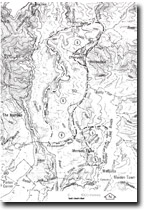
6. Aberfeldy River
This information has been developed from the publications:
|
Location: | 484028 to 500100. Aberfeldy River Valley, from the junction of the Aberfeldy and Thomson River to the crossing of the Walhalla-Aberfeldy Road. | |
Access: | Low Saddle Track, via Walhalla-Aberfeldy Road. | |
Ownership: | Crown Land (Baw Baw National Park). | |
Geology/Geomorphology: | The Aberfeldy River has incised a deep valley in Walhalla and Jordan River Group Sediments. The valley is characterised by entrenched meanders, gorge sections, small alluvial terraces, point bars, gravel races and rapids. The steep valley slopes and gorge sections provide exposures of Norton Gully Sandstone, Wilson Creek Shale and Boola Formation sediments while the orientation of the river in parts of the lower sections is controlled by faulting. | |
Significance: | Regional. The Aberfeldy River Valley section specified provides a representative example of the features associated with the widespread and highly dissected terrain developed by river and stream incision of the Lower Devonian sediments. | |
Management: | Dam construction on either the Thomson River below the junction with the Aberfeldy, or on the Aberfeldy River below the Walhalla-Aberfeldy Road bridge should be prohibited. | |


