
5. Walhalla Goldfield
This information has been developed from the publications:
|
Location: Access: Ownership: | 518004. Walhalla. Erica-Walhalla Road. Crown Land and Private Land. | 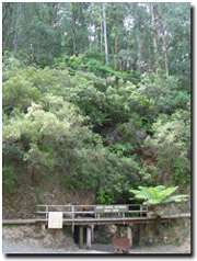 Entrance to Long Tunnel Extended Mine |
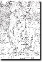
A more or less continuous auriferous belt extends 80 kilometres from Walhalla to Woods Point. The gold mineralisation is associated with dyke intrusion of Walhalla Group sediments with the gold bearing quartz reefs commonly occurring along or sub-parallel to the dykes, or in shears or fractures cutting across dyke bulges. The Long Tunnel group of mines at Walhalla is representative of the former type, while the Toombon mine (475232) is one of the few important mines in this area where the gold bearing quartz reefs were not associated with dyke rocks.
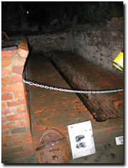 Remains of boiler room in Long Tunnel Extended Mine | Significance: State. The Long Tunnel group of mines were the largest in eastern Victoria and are representative of the mode of mineralisation which extends northward to Woods Point. They are of particular importance for their historical interest as there is abundant evidence of the results of mining, e.g. spoil heaps, adits, shafts, and relict machinery. Management: All the mines are now abandoned and derelict, and safe access to the mineralisation zones is no longer possible. Reclamation along the lines of the tourist development at the Long Tunnel Extended mine at Walhalla or recommencement of commercial mining are means by which the potential of these areas may be utilised. |
References:
Douglas, J.G. and Ferguson, J.A. (eds.) 91976): Geology of Victoria. Spec. Publ. geol. Soc. Aust.,5.
Whitelaw, O.A.L., (1916), The topography, geology and mines of trhe Woods Point district. Mem. geol. Surv. Vict., 13.
© State of Victoria (Agriculture Victoria) 1996 - .

This work, Victorian Resources Online, is licensed under a Creative Commons Attribution 4.0 licence. You are free to re-use the work under that licence, on the condition that you credit the State of Victoria (Agriculture Victoria) as author, indicate if changes were made and comply with the other licence terms.
The licence does not apply to ‘branding’ or some ‘images or photographs’ that may be owned by third parties. We ask you to seek prior approval to use images using the VRO feedback form. Access to higher quality images can also be provided on request.
This page was last updated on .