2. Deep Creek
|
This information has been developed from the publications:
|
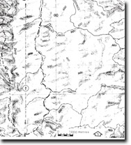
| Location: | 573063 to 578974. Deep Creek Valley between the Thomson River and the junction of the east and west branches of Deep Creek. |  Site 8222-2 |
Access: | Gladstone Track, Lammars Track, Deep Crack 2 Track from MaindenTown Road. | |
Ownership: | Crown Land. | |
| Geology/Geomorphology: | Deep Creek has cut a deeply incised valley in Lower Devonian sediments. The valley is characterised by steep vegetated slopes with only poor outcrop. Areas of good outcrop are restricted to the creek channel and here sandstones, siltstones, and conglomerates of the Boola Formation are exposed. These outcrops, although restricted, have yielded an important fossil fauna (chiefly molluscs and brachiopods). | |
Significance: | Regional. The fossilferous outcrops in Deep Creek are of great importance in determining the stratigraphic relationships of the Devonian rocks of the area. | |
Management: | As the most important outcrops occur in the creek channel these may be obscured by dam construction either in the Thomson River downstream from the junction with Deep Creek, or in Deep Creek, below the junction of the east and west branches. Such activities should be prohibited. | |
References: | Talent, J.A.1956. Siluro-Devonian brachiopods from Marble Creek, Thomson River, victoria. Proc. R. Soc. Vict., 68, pp.73-84. Talent, J.A and Philip, G.M. 1956. Siluro-Devonian mollusca from Marble Creek, Thomson River, Victoria. Proc. R. Soc. Vict., 68, pp. 57-72. VandenBerg, A.H.M. 1975. Definitions and description of middle Ordovician to middle Devonian rock units of the Warburton district, East Central Victoria. Rep. geol. Surv. Vict., 1975/6. | |


