
10. Agnes River Estuary
This information has been developed from the publication:
|
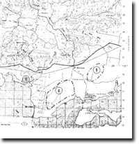
Location: | 455181. Three kilometres south-west of Agnes Railway Station. | |
Access: | Barry Road, private roads south of the South Gippsland Highway. | |
Ownership: | Crown Land along coast, private land. | |
Geology/Geomorphology: | The estuary of the Agnes River describes several very tight meanders that sweep across the entire width of the incised flood plain north of Barry Beach. The estuary is fringed by a dense stand of mangroves (Avicennia marina) and there are broad expanses of the tidal flats occupied by rice-grass (Spartina townsendii). The meander pattern of the channel continues across the sandy inter-tidal and sub-tidal sand flats south of the river mouth. | |
Significance: | Regional. This is one of the most rigorous growth areas of the introduced marsh grass Spartina. Studies of the physiographic effects of this growth are continuing. | |
Management: | Dredging or filling of the estuarine section should be prohibited. | |
© State of Victoria (Agriculture Victoria) 1996 - 2025.

This work, Victorian Resources Online, is licensed under a Creative Commons Attribution 4.0 licence. You are free to re-use the work under that licence, on the condition that you credit the State of Victoria (Agriculture Victoria) as author, indicate if changes were made and comply with the other licence terms.
The licence does not apply to ‘branding’ or some ‘images or photographs’ that may be owned by third parties. We ask you to seek prior approval to use images using the VRO feedback form. Access to higher quality images can also be provided on request.
This page was last updated on 25/01/2019.