
5.7.2 Modern floodplains with co-dominant calcareous linear dunefields
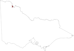
5. North Western Dunefields and Plains (DP)
5.7 Modern floodplains within dunefields
5.7.1 Modern floodplains
| The River Murray floodplains to the east and north-east of Hattah are partially covered by dunes blown in from the west. Dune alignment varies from east to west and from north-east to south-west. Reddish-yellow sands occur on the dunes and narrow swales, with vegetation and erosion susceptibility similar to those in unit 5.1.1. The broader flats have grey clay soils similar to those in 5.7.1. |
 |
© State of Victoria (Agriculture Victoria) 1996 - .

This work, Victorian Resources Online, is licensed under a Creative Commons Attribution 4.0 licence. You are free to re-use the work under that licence, on the condition that you credit the State of Victoria (Agriculture Victoria) as author, indicate if changes were made and comply with the other licence terms.
The licence does not apply to ‘branding’ or some ‘images or photographs’ that may be owned by third parties. We ask you to seek prior approval to use images using the VRO feedback form. Access to higher quality images can also be provided on request.
This page was last updated on .