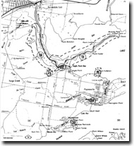
GL22 (8422) Eagle Point Bluff
|
This information has been developed from the publications:
|
| Location: | 593062 (8422). Eagle Point Bluff lookout above the Mitchell River. | |
Abstract: | Type locality of Eagle Point Sand Member of Haunted Hill Gravel. | |
Access: | Road from Eagle Point - Point Dawson Road or boat in the Mitchell River. | |
Ownership: | Crown land. | |
Geomorphology:: | A river cliff exposes 20 metres of sands overlain by gravels on the southern bank of the Mitchell River. The cliff is actively undercut by the river. The beds are a sandy facies of the Haunted Hill Gravels and are named the Eagle Point Sand Member. | |
Significance: | Regional. This is a type locality and clearly indicates the predominant sandy rather than gravely characteristics of much of the Haunted Hill Gravels. | |
Management: | The precipitous and unstable nature of the cliff makes inspection difficult and dangerous. It is probably better to direct interested parties to the section at Tyers Creek (GL-21). |


