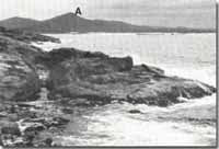
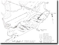
8822-4 Howe Range
Sites 8822 1 to 10 - Mallacoota to Cape Howe
Page top
This information has been developed from the publications:
|
Location: | 552446. Nine kilometres east of Mallacoota Inlet. |  Eastern shore of Gabo Island and Howe Range. |
Abstract: | Granite peak and hillslopes with tors. | |
Access: | A little used 4-wheel drive track leads from near Bucklands farm east of Mallacoota inlet. | |
Ownership: | Crown Land (Croajingolong National Park). | |
Geology: | The rock is a red biotite granite of Late Middle to Early Upper Devonian age and is one of the youngest granitic intrusions in eastern Victoria. | |
Geomorphology: | Howe Hill is a prominent peak with minor tor development. A spur extending south-eastward defines the easternmost limit of, and forms the catchment for, the Howe Flat/Lake Barracoota wetland. | |
Significance: | Regional. The dark red granite contrasts with the lighter coloured intrusive bodies of East Gippsland. The range has major importance as the catchment for Lakes Barracoota and Wau Wauka. | |
Management: | Logging, roadworks, and other land use which may result in serious vegetation disturbance should be prohibited in the Howe Range so the water quality in the adjacent lake systems is preserved. | |
References: | Rosengren, N. J. 1978. The Physiography of Coastal Dunes, East Gippsland, Victoria. M. A. Thesis (Unpub.), University of Melbourne | |
 Sites 8822-1 to 10 |


