8723-8 Cann River Valley
|
This information has been developed from the publications:
|
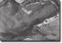
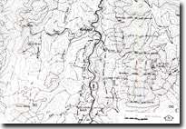
Location: | 946615 to 940540. The Cann River valley from Weeragua to near Noorinbee North. |  Braided stream (arrowed) and narrow alluvial valley of the Cann River at Weeragua. |
Abstract: | Fault controlled river valley. | |
Access: | Cann Valley Highway. | |
Ownership: | Predominantly private land. | |
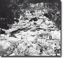
Geology/Geomorphology: | Noorinbee Granodiorite is well exposed in the Cann River where the river has incised a deep valley orientated north south along a major fault lineament. The granodiorite is highly fractured and to the north near Noorinbee North a doleritic dyke has intruded along a major fracture trending north west. Wedges of Ordovician sandstones and slates are faulted against the granodiorites and these sediments are exposed in the Archie Hill area, immediately east of the Cann River. Small deposits of alluvium occur in the widened valley sections, upstream from Noorinbee North and larger alluvial deposits occur downstream from Noorinbee where the valley widens considerably. River bank erosion has exposed the contact between this alluvium and the granodiorite to the granodiorite to the north of the Noorinbee bridge. | |
Significance: | Local. Good example of a structurally controlled river valley. | |
Management: | Flooding of the river valley through the construction of major reservoirs would detract from the significance of the site. | |
 Noorinbee. Contact (dotted) between alluvial sediments (A) overlying granite (B). |


