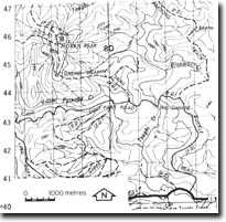
8722-10 Morris Peak
|
This information has been developed from the publications:
|
Location: | 783457. 13 kilometres west north-west of Cann River. | |
Abstract: | Exposures of hornfelsic rocks. | |
Access: | Buckle Trail. | |
Ownership: | Crown Land. | |
Geology: | Intrusions of the Noorinbee Granodiorite into Ordovician sediments has produced hornfelsic contact metamorphic rocks which outcrop on the eastern slopes of Morris Peak. | |
Significance: | Local. Alteration of Ordovician sediments through contact metamorphism associated with intrusion of the Bege Batholith is widespread in this region. Morris Peak provides an easily accessible and representative exposure of these metamorphic rocks. | |
Management: | Access to the sight should be maintained. | |


